Trekking in Mustang Region
A Journey into the Last Forbidden Kingdom of Nepal
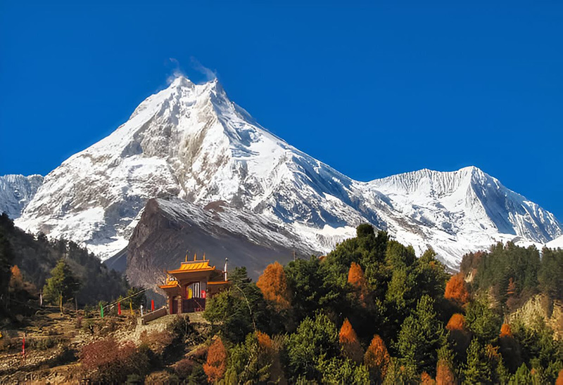
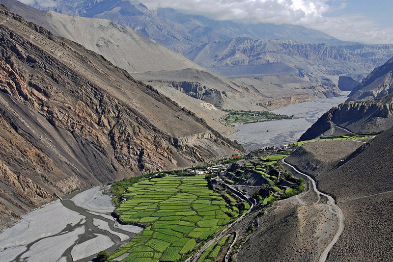
The Mustang region of Nepal is unlike any other trekking destination on earth. Sealed behind the rain shadow of the Annapurna and Dhaulagiri massifs — two of the world’s highest mountains rising on either side of the Kali Gandaki gorge — Mustang receives almost no monsoon rainfall. While the rest of Nepal turns green and wet from June through August, Mustang remains arid, windswept, and open: a high-altitude desert of ochre cliffs, red-walled canyons, and ancient cave dwellings that baffled archaeologists when they were discovered to hold 2,000-year-old remains. The landscape does not look like Nepal. It looks like the Tibetan plateau that lies just beyond the border to the north — because geologically, culturally, and historically, it is.
Upper Mustang was an independent kingdom — the Kingdom of Lo — from approximately 1380 until 2008, when Nepal formally abolished its royal family system. The walled capital of Lo Manthang, built by the warrior king Ame Pal in 1380 at 3,840 meters above sea level, remains one of the few intact medieval walled cities in the world. Within its mud-brick walls, four major monasteries and a royal palace that the cultural king still inhabits have preserved a living tradition of Tibetan Buddhist culture that has survived largely unchanged for six centuries. Upper Mustang was completely closed to foreign visitors until 1992, and the restricted area permit system that controls access today is the mechanism by which the Nepali government continues to limit visitor numbers and protect what survives.
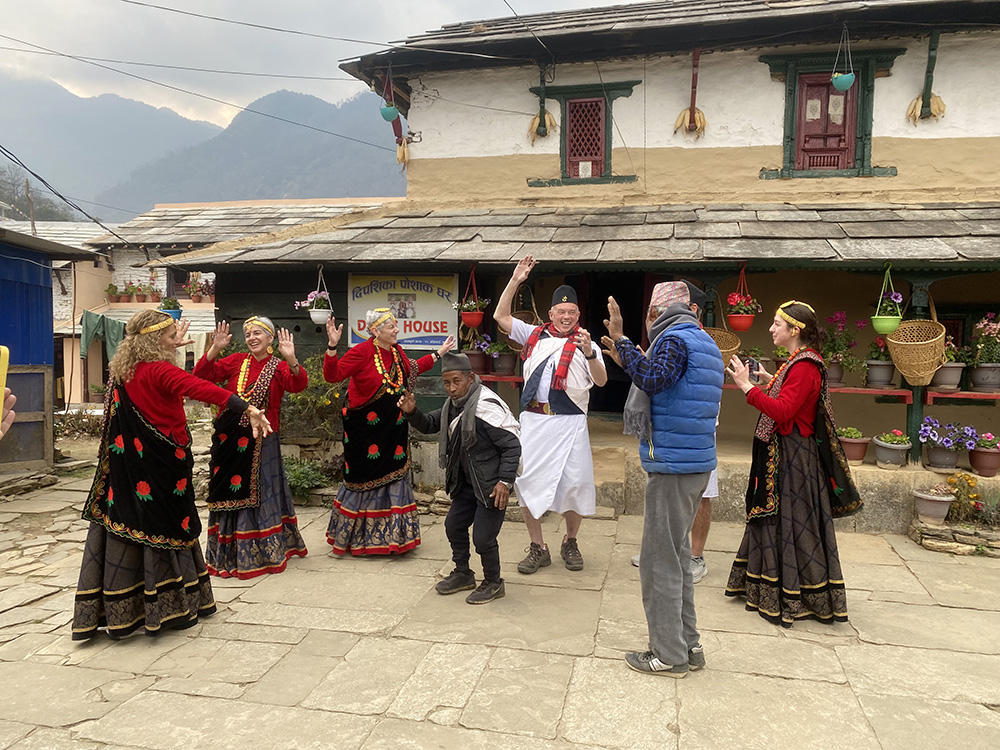
The Loba people — ethnically and linguistically Tibetan, descended from communities that settled the upper valley centuries ago — are the cultural anchors of the region. Their architecture, language, clothing, agricultural practices, and religious traditions differ fundamentally from the Nepali population of the southern lowlands and from the Gurung and Thakali communities of the mid-hills. Walking through a Loba village feels like crossing a cultural border even though you have not left Nepal. The narrow alleys of Lo Manthang, the butter lamps burning in monastery alcoves, the chortens and mani walls at every trail junction, the wind-polished prayer flags over every rooftop — these are expressions of a culture that has endured because of its isolation, not despite it.
At Getaway Nepal Adventure, we operate five distinct routes across the Mustang region — from the classic sixteen-day Upper Mustang Trek to the Tiji Festival expedition, the overland jeep tour, the motorbike adventure, and the comprehensive Mustang Circuit. Every route requires the restricted area permit for Upper Mustang, a licensed guide, and the kind of logistical preparation that the region’s remoteness demands. We have been running these routes for years and have the local relationships, permits expertise, and emergency protocols that make the difference between a life-defining journey and a frustrating one.
Mustang Region Treks and Tours at a Glance
The Mustang region has more route variety than most trekkers realize — traditional trekking, overland jeep tours, motorbike adventures, and festival expeditions all operate in the same landscape. The table below compares every option so you can match your available time, budget, and interest to the right itinerary before exploring the individual packages.
| Route | Days | Style | Max Altitude | Price From |
| Upper Mustang Trek | 16 | Trekking | 3,840m / 12,598ft (Lo Manthang) | USD 2,050 |
| Tiji Festival Trek 2026 | 16 | Trek + Festival | 3,840m / 12,598ft | USD 2,160 |
| Mustang Circuit Trek | 16 | Trekking | 3,840m / 12,598ft | USD 2,259 |
| Upper Mustang Overland Tour | 14 | Jeep / 4WD | 3,840m / 12,598ft | USD 1,770 |
| Upper Mustang Motorbike Tour | 13 | Motorcycle | 3,840m / 12,598ft | Enquire |
| Lower Mustang Trek | 14 | Trekking | 3,800m / 12,467ft (Muktinath) | USD 1,450 |
All Upper Mustang routes require the Restricted Area Permit (RAP), ACAP, and a licensed guide — our team handles all documentation. Lower Mustang requires ACAP only; no RAP. All packages are fully customizable by departure date, group size, and pace.
Upper Mustang vs. Lower Mustang: Understanding the Difference
The term “Mustang region” covers two geographically and experientially distinct zones that require different permits, offer different landscapes, and attract different types of trekkers. Knowing which zone fits your goals before you commit to an itinerary saves confusion and disappointment.
Lower Mustang: The Kali Gandaki Valley
Lower Mustang covers the southern half of the Mustang district — the Kali Gandaki valley from Jomsom northward to Kagbeni, and the side valleys leading to Muktinath. This is accessible territory: the road from Pokhara reaches Jomsom, a domestic flight covers the same distance in twenty-five minutes, and the main trail from Jomsom to Muktinath is within the Annapurna Conservation Area. No restricted area permit is required.
The landscapes here are already dramatic by any standard other than what waits to the north. The Kali Gandaki gorge — flanked by Dhaulagiri at 8,167 meters and Annapurna I at 8,091 meters, with a vertical relief between summits and valley floor of more than 5,500 meters — is by many measures the deepest gorge on earth. The river carries black ammonite fossils (shaligrams) from the ancient Tethys seabed, considered sacred by Hindus and collected by the Thakali people of the valley. Jomsom is a Thakali town with excellent infrastructure — teahouses, restaurants, an airport, and the characteristic afternoon winds that blow so hard down the valley that trekkers time their walking to finish before midday. The pilgrimage center of Muktinath, at 3,800 meters, is the highlight of Lower Mustang: a temple complex sacred simultaneously to Hindus and Tibetan Buddhists, where natural gas flames have burned for centuries alongside the water outlets used for ritual bathing.
Our fourteen-day Lower Mustang Trek gives full access to this southern zone with a pace that allows proper exploration of the Kali Gandaki gorge, the Thakali villages of Marpha and Tukuche, and the pilgrimage sites above Kagbeni. This is the right choice for trekkers who want the Mustang landscape experience without the additional cost and permit complexity of Upper Mustang.
Upper Mustang: The Restricted Kingdom Beyond Kagbeni
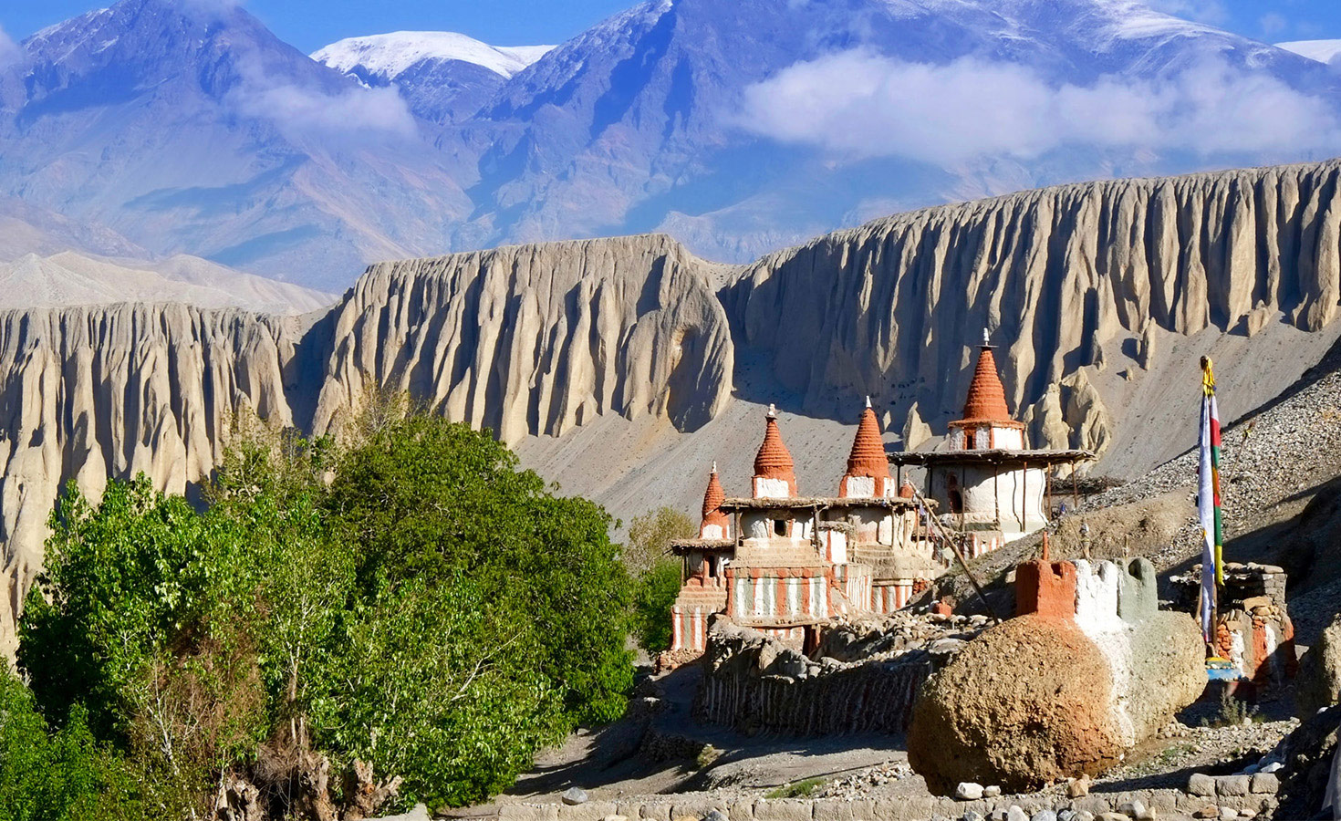
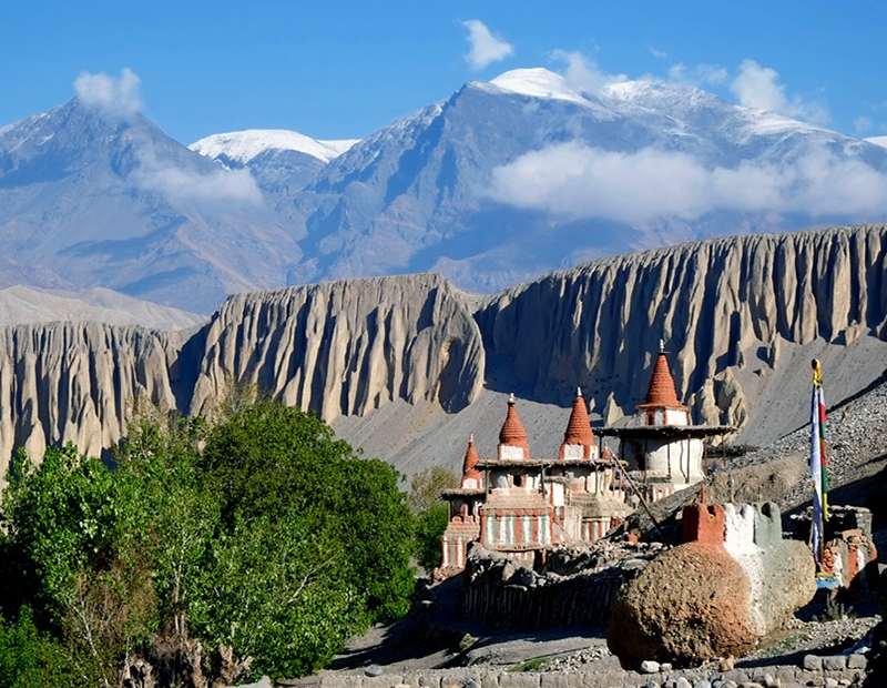
Everything north of Kagbeni is Upper Mustang — the restricted zone that requires a separate Restricted Area Permit, a licensed guide, and a registered trekking agency to access. The landscape changes almost immediately past the Kagbeni checkpoint. The green Kali Gandaki riverbanks give way to bare red-brown cliffs, wind-carved into formations that look geological only in an abstract sense — they look, more concretely, like the work of centuries of erosion on iron-rich sandstone, and they photograph unlike anything else in the Himalayan trekking world.
The trail climbs through a series of villages — Chele, Samar, Syangbochen, Ghami, Tsarang — each with ancient monasteries, mani walls, and cave structures in the cliffs above. Fossils appear in the river gravel and embedded in exposed cliff faces. Apricot orchards and barley fields mark the village outskirts in colors that seem implausible against the surrounding desert. At Charang, the village that was once Mustang’s regional capital before Lo Manthang, a monastery preserves some of the finest 15th-century Tibetan Buddhist murals still accessible to visitors outside Tibet itself.
Lo Manthang: The Walled Capital of the Kingdom of Lo
Lo Manthang is the destination that defines Upper Mustang trekking. Founded in 1380 by the warrior king Ame Pal, it is one of the few remaining medieval walled cities in the world where people still live, work, and maintain active religious practice within the original walls. The walls themselves — roughly rectangular, approximately three to four meters high and built from the same sun-dried mud brick as the houses inside — enclose a dense cluster of whitewashed houses, narrow cobblestone alleys, and four major monasteries that represent the spiritual center of the Kingdom of Lo tradition.
Within the walls, Jampa Lhakhang — the “God House,” built in the 15th century — contains some of the finest Buddhist mandalas and gold-painted statuary in the entire trans-Himalayan region. Thubchen Gompa, a massive red assembly hall that dates to the peak of the kingdom’s power, preserves original murals of extraordinary quality. The Royal Palace, a four-story whitewashed structure that stands at the north end of the city, remains the residence of the cultural king of Mustang — the role is now ceremonial rather than political, but the continuity of occupation matters. A family has lived in that building since the 15th century.
Outside the walls, the upper approaches to Lo Manthang reveal the sky caves that have attracted global archaeological attention since the 1990s. Carved into the cliff faces surrounding the city — some accessible, some reachable only with climbing equipment — approximately 10,000 ancient cave dwellings have been identified in the Upper Mustang region. Excavations have yielded human remains more than 2,000 years old, ritual artifacts, manuscripts, and painted murals. No one knows with certainty who created them, how people accessed the highest caves (some perched 150 feet above the valley floor), or what social function the entire system served. The mystery is part of the appeal, and guided day trips to accessible caves near Lo Manthang are now a standard element of Upper Mustang itineraries.
Upper Mustang Trekking Permits 2026: Complete and Current Information
This is the most frequently misunderstood aspect of Upper Mustang planning. Permit costs and rules have changed significantly since November 2025, and a large amount of outdated information — including on many Nepal travel websites — is still circulating online. The information below is current and verified for the 2026 trekking season.
MAJOR 2026 UPDATE: The $500 Flat Fee Has Been Abolished
- The old $500 per person / 10-day flat-rate permit that defined Upper Mustang access for three decades was officially abolished in November 2025.
- The new system charges USD $50 per person per day — you pay only for the days you are physically inside the restricted zone.
- This makes shorter itineraries (4-7 days) significantly more affordable than before. A 7-day trip now costs $350 rather than $500.
- The two-trekker minimum requirement was also abolished in March 2026. Solo trekkers may now obtain the permit through a registered agency.
- A licensed guide is still mandatory — solo unguided access is not permitted.
| Permit | Cost 2026 | Who Needs It | Where Obtained |
| Restricted Area Permit (RAP) | USD $50 per person per day inside restricted zone | All foreign nationals entering above Kagbeni — mandatory | Department of Immigration, Kathmandu or Pokhara — through a registered agency only. Cannot be obtained independently. |
| Annapurna Conservation Area Permit (ACAP) | NPR 3,000 (~USD 22-25) for foreign nationals / NPR 1,000 for SAARC | All trekkers — Upper Mustang lies within the ACAP zone | Nepal Tourism Board office, Kathmandu or Pokhara ACAP counter |
| TIMS Card | Approximately USD $8–15 for agency trekkers | Required for all trekkers in the Mustang region | NTB or TAAN office in Kathmandu or Pokhara — through your agency |
Example permit costs for a 10-day Upper Mustang itinerary (2026):
- RAP: 10 days × USD $50 = USD $500 per person
- ACAP: NPR 3,000 (~USD $23) per person — one-time fee
- TIMS: approximately USD $10 per person — one-time fee
- Total permit cost: approximately USD $533 per person for a 10-day Upper Mustang itinerary
The RAP must be obtained exclusively through a registered Nepali trekking agency. You cannot walk into the Department of Immigration independently and obtain one. The permit is issued only in Kathmandu or Pokhara — not at any checkpoint on the trail. The entry checkpoint at Kagbeni and the exit checkpoint near Lo Manthang both verify permits and guide credentials. Trekking Upper Mustang without a valid RAP carries fines of up to USD $5,000 and immediate deportation.
Getaway Nepal Adventure handles all three permit types as part of every standard Upper Mustang package. You provide your passport, Nepal visa details, and travel insurance — we handle everything else before your departure from Kathmandu.
The Landscape of Mustang: A Desert Above the Clouds
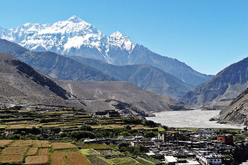
The physical geography of the Mustang region is the consequence of one dominant fact: it lies north of the Himalayan main range. While monsoon moisture from the Bay of Bengal is forced upward by the Annapurna and Dhaulagiri massifs and drops its rainfall on the southern slopes, the northern Mustang plateau receives almost none of it. The annual rainfall in Jomsom averages approximately 292 millimeters — comparable to a semi-arid steppe environment. In Lo Manthang, it is even less.
The Kali Gandaki Gorge
The Kali Gandaki River is the organizing geographic feature of the Mustang district. Rising in Tibet and flowing south through the district, it has carved what is measured by many geographers as the deepest gorge on earth — the distance between the summit of Dhaulagiri to the west (8,167 meters) and the summit of Annapurna I to the east (8,091 meters) spans a horizontal distance of approximately 22 kilometers, while the valley floor between them sits at roughly 2,520 meters. The vertical relief from valley to summit reaches approximately 5,500 meters on either side.
For trekkers, the gorge is experienced most directly on the Lower Mustang and Jomsom Muktinath routes, where the trail follows the riverbed northward into increasingly arid country. The characteristic afternoon winds — rushing downvalley from the north with enough force to slow a hiker walking into them — are created by the temperature differential between the hot southern lowlands and the cool Tibetan plateau drawing air through the gorge like a funnel. By midday, the wind is strong. By early afternoon, walking against it is genuinely difficult. Experienced trekkers complete their walking before lunch.
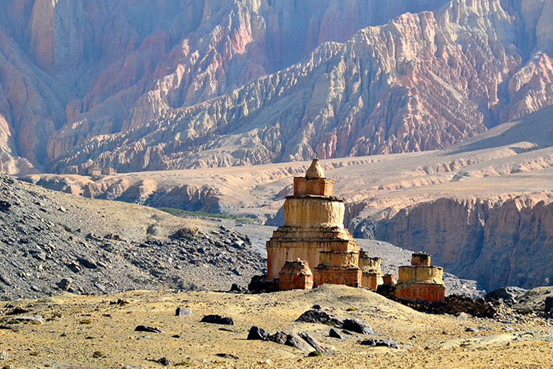
The Red Cliffs and Canyon Country
Above Kagbeni, the Mustang landscape takes on the character that makes it unlike anywhere else in Nepal. The sedimentary geology of the upper valley produces cliff faces in shades of red, orange, and brown that change color as the sun moves across the sky. Erosion has carved these formations into shapes — towers, arches, caves, overhangs — that would be remarkable in any landscape but feel surreal in the context of a Himalayan trek. The village of Dhakmar, below which a long red cliff face towers in what photographers describe as Martian red, is one of the most photographed single landscapes in the entire Mustang circuit.
The plateau surfaces above the canyons are flat and wind-scoured, punctuated by chortens and the occasional tent of a nomadic yak herder. On clear days — which are most days in Mustang, regardless of season — the views extend to the Tibet border peaks to the north and to the Annapurna and Dhaulagiri massifs to the south. The light in Upper Mustang is extraordinary: high altitude, low humidity, and minimal air pollution produce a quality of clarity that photographers and painters who have worked here describe as uniquely demanding — there is nowhere to hide in a landscape this open and this lit.
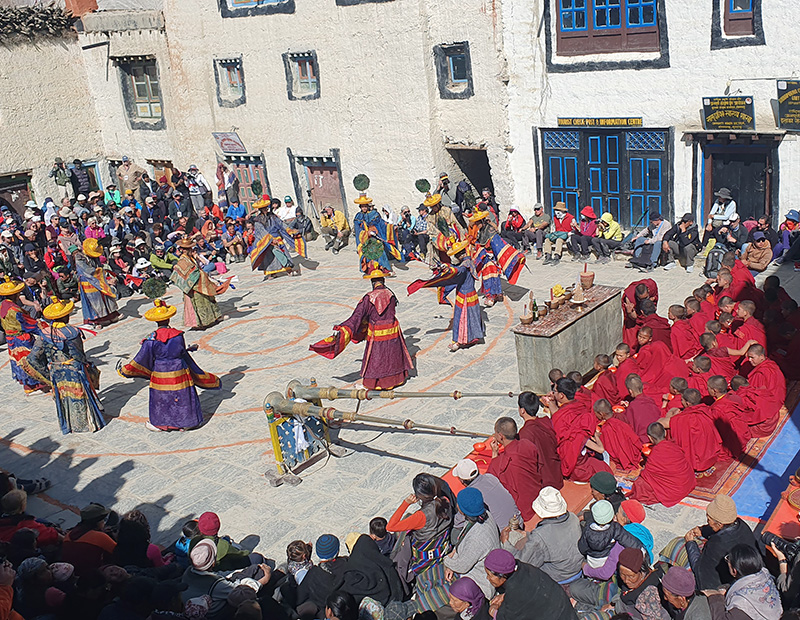
The Tiji Festival: Mustang’s Most Sacred Annual Celebration
The Tiji Festival — formally called Tenpa Chirim, meaning “Prayer for World Peace” in Tibetan — is a three-day Vajrayana Buddhist ritual celebrated annually in the royal courtyard of Lo Manthang. In 2026, the festival falls on May 13, 14, and 15. It is the single most significant annual event in the upper Mustang calendar and one of the most compelling cultural experiences available anywhere in the Himalayan world.
The Mythology
The festival commemorates the legend of Dorje Jono — a deity, son of a demon, whose father’s destructive behavior was bringing drought, disease, and calamity to the Kingdom of Lo. After a prolonged spiritual battle fought across multiple realms, Dorje Jono defeats his father and banishes the evil forces, restoring rain, fertility, and peace to the kingdom. The three days of the festival re-enact this story through costumed masked dances performed by approximately 65 monks from the Choedhe Monastery — the Sakya-sect monastery that serves as the spiritual center of Upper Mustang and the organizational heart of the festival.
The culmination of the third day is visceral: after a sequence of increasingly intense ritual dance sequences performed in the palace courtyard in front of thousands of gathered Loba people and their guests, a straw effigy of the demon is carried into the open desert beyond Lo Manthang’s walls, ritually pierced with a sacred dagger, and destroyed. Ancient muskets are fired into the sky. The crowd shouts “Lha Gyalo!” — “May God be victorious.” According to local belief, rain will follow.
What the Festival Looks Like
On all three days, the royal courtyard fills from early morning with Lo Manthang’s resident population and pilgrims from surrounding villages. Monks in elaborate brocade robes and carved wooden masks representing deities, demons, and animal spirits perform choreographed sequences accompanied by long horns, cymbals, and drums whose sound carries across the desert. On the second day — considered the heart of the festival — 400-year-old sacred thangka paintings are unrolled and displayed across the face of the Tashi Gephel Palace, visible only during this annual ceremony.
For trekkers, the Tiji Festival represents an opportunity to witness a living religious tradition of extraordinary continuity performed for its own community — not as a performance for tourists but as a genuine act of collective belief. You are a guest at something that would happen whether you were there or not. That distinction matters and shapes how the experience feels.
Planning for the Tiji Festival Trek
Our sixteen-day Tiji Festival Trek is structured around the confirmed May dates — a departure from Kathmandu approximately ten days before the festival begins gives time for the Pokhara flight, the Jomsom arrival, and the trek north through the Kali Gandaki valley to Lo Manthang with appropriate acclimatization at each stage. Accommodation in Lo Manthang during the festival fills many months in advance — we begin accepting bookings for the following year’s festival immediately after the current year’s dates are confirmed. If you are considering the Tiji Festival Trek for 2027, contact us as early as possible.
Best Time to Trek the Mustang Region
The Mustang region’s rain-shadow position makes it genuinely attractive in more seasons than most trekking destinations in Nepal. The standard Himalayan trekking calculus of “spring and autumn are good, monsoon is bad” applies very differently here.
Spring: March Through May
Spring is one of the two principal trekking windows. March and April offer good trail conditions and manageable temperatures in the upper valley. May brings the Tiji Festival — for trekkers whose primary interest is the festival, the route and timing are fixed. The lower Kali Gandaki gorge sees strong afternoon winds from March onward, making early morning starts essential. Temperatures in Lo Manthang in April typically range from zero to 15 degrees Celsius during the day, dropping below freezing at night.
Monsoon: June Through August — Mustang’s Unique Advantage
The Mustang region’s most important seasonal distinction is its usability during the monsoon. While heavy rainfall shuts down trekking across most of Nepal from June through August, the rain-shadow position of Upper Mustang means the region receives a fraction of the rainfall experienced south of the Himalayan main range. Many experienced trekkers deliberately choose June and July for Upper Mustang specifically because the region remains accessible while competitor destinations are closed.
The landscape in early monsoon is striking: the desert cliffs and canyons are at their most vivid color, the air is relatively clear because monsoon dust has been washed from the atmosphere to the south, and the absence of other trekking groups provides a degree of solitude that spring and autumn cannot match. Accommodation is available and guides are less booked. The trail conditions are generally excellent above Kagbeni. The one variable to watch is the lower Kali Gandaki approach — heavy rainfall further south occasionally affects the river crossing sections between Jomsom and Kagbeni.
Autumn: September Through November
Autumn is the other main trekking window and the preferred season for most first-time Upper Mustang visitors. The monsoon clears in mid-September, the skies over the upper valley are crisp and clear, and October through November offers consistently stable weather with excellent visibility. The trail infrastructure is at its most available and well-maintained. Temperatures in October are cold but comfortable for walking — typically 5 to 12 degrees Celsius in the upper valley during the day.
Winter: December Through February
Winter in Upper Mustang is cold — nighttime temperatures in Lo Manthang can drop to minus 15 degrees Celsius, and some years bring sufficient snowfall to close the higher trail sections above Ghami. The winter trekking season is viable for properly equipped and experienced trekkers, but the region is not serviced in winter the way spring and autumn routes are. Some teahouses above Jomsom close for the winter. The overland jeep tour is generally more practical than trekking for winter Mustang visits.
Getting to the Mustang Region
The Mustang region is accessed via Jomsom — the district headquarters and airport town of the Mustang district, located in the lower Kali Gandaki valley at 2,720 meters. From Jomsom, trekking and vehicle routes extend north into Upper Mustang. There are two primary ways to reach Jomsom from Kathmandu.
Option 1: Fly Kathmandu to Pokhara, Then Pokhara to Jomsom
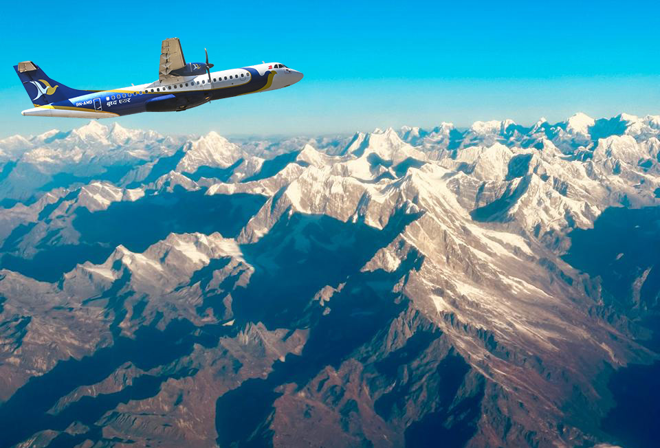
The standard approach for most Upper Mustang trekkers. A Kathmandu to Pokhara domestic flight takes twenty-five minutes, and a Pokhara to Jomsom flight takes a further thirty-five minutes. The Jomsom airport has a short runway with a strong crosswind component and operates only in the early morning before the characteristic valley winds build — all Jomsom flights depart before 9:00 AM. Weather cancellations are more frequent at Jomsom than at Lukla; build a buffer day into your Pokhara schedule.
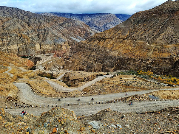
From Jomsom, trekking routes head northward along the Kali Gandaki to Kagbeni (the Upper Mustang entry checkpoint) and beyond. The overland jeep tour uses the same road that now runs from Jomsom all the way to Lo Manthang — a route that has transformed the logistics of Upper Mustang access over the past decade, making road-based exploration viable alongside traditional trekking.
Option 2: Drive from Pokhara to Jomsom via the Kali Gandaki Highway
A road now connects Pokhara to Jomsom via Beni and Tatopani, following the Kali Gandaki river valley northward. The drive takes approximately eight to ten hours under good conditions. This route is popular for the overland jeep tour and motorbike expedition itineraries, which use the road for most or all of their approach. For trekkers, the road journey is used less frequently than the flight, but it provides a ground-level perspective on the gorge country that the flight bypasses.
How Challenging Is Trekking in the Mustang Region?
The Mustang region covers a wide difficulty range depending on which route you choose. The critical variables are altitude, daily distance, and the wind — which is a consistent physical factor on all Mustang trails from mid-morning onward.
| Route | Daily Walking | Max Altitude | Difficulty | Notes |
| Lower Mustang Trek | 4-6 hours | 3,800m (Muktinath) | Easy-Moderate | Well-established trail; no restricted area. Suitable for fit beginners. |
| Upper Mustang Trek | 5-7 hours | 3,840m (Lo Manthang) | Moderate | Altitude is moderate; challenge is length and remoteness, not technical difficulty. |
| Tiji Festival Trek | 5-7 hours | 3,840m | Moderate | Same as Upper Mustang Trek with festival timing built in. Book months ahead. |
| Mustang Circuit Trek | 6-8 hours | 3,900m+ | Moderate-Strenuous | Longer loop with more remote sections. Physically demanding but non-technical. |
| Overland Jeep Tour | Minimal walking | 3,840m | Low | Vehicle-based; significant altitude but no sustained walking challenge. |
| Motorbike Tour | Riding, not walking | 3,840m | Moderate (riding skill) | Requires confident off-road motorcycle experience. Not recommended for beginners. |
A key point that surprises many Mustang trekkers: the maximum altitude of Lo Manthang (3,840 meters) is lower than Everest Base Camp and lower than the highest points on the Annapurna Circuit. The physical challenge of Upper Mustang trekking is not extreme altitude — it is consistent daily distance at altitude, the relentless afternoon wind, and the remoteness of the upper valley where support infrastructure is limited. Our itineraries build appropriate acclimatization nights and rest days specifically for these conditions.
The afternoon winds deserve specific attention in planning. By 11:00 AM to 12:00 PM, winds in the upper Kali Gandaki valley and on exposed ridge sections above Kagbeni become strong enough to make walking uncomfortable. Our guides build itineraries that complete exposed sections in the morning and use the afternoon for descents into sheltered villages or for monastery visits and village exploration.
Why Trek the Mustang Region with Getaway Nepal Adventure
Upper Mustang is one of the most logistically complex trekking destinations in Nepal — restricted area permits, mandatory guide requirements, limited trail infrastructure, and the particular demands of operating in a genuinely remote restricted zone all separate well-organized from poorly-organized operations. The consequences of inadequate planning are more significant here than on any other region in our portfolio.
Permit Expertise and Processing Speed
The Restricted Area Permit for Upper Mustang must be obtained through a registered agency — there is no independent route. We have processed RAP applications for Upper Mustang for years and know the system, the timelines, and the documentation requirements precisely. In peak season, when the Department of Immigration in Kathmandu is processing high volumes, experienced agencies get their applications through faster. We confirm permit availability before you book, not after.
Guides with Direct Lo Manthang Experience
Our Upper Mustang guides have personally made multiple crossings of the complete route to Lo Manthang and back. For the Tiji Festival Trek, we use guides who have attended the festival multiple times and understand the access, timing, and cultural protocols involved. A guide who has seen the festival once cannot anticipate the way a guide who has attended eight times can — where to position for the best view of the masked dances, which alley to take to reach the palace courtyard before the crowds fill it, which monastery is conducting early morning practice that trekkers can observe.
Contingency Planning for Jomsom Flights
Jomsom airport has a higher weather cancellation rate than any other domestic airport in Nepal. Early morning fog, high winds, and seasonal visibility issues affect schedules regularly, particularly in spring. We build buffer days into every Upper Mustang itinerary specifically for this. We also maintain vehicle standby capacity for road approaches when flights are delayed beyond the buffer. If your Jomsom flight is cancelled, you will not miss Lo Manthang because we did not plan for it.
Frequently Asked Questions About Trekking in the Mustang Region
Q1: How much does the Upper Mustang permit cost in 2026?
The Restricted Area Permit (RAP) for Upper Mustang costs USD $50 per person per day inside the restricted zone in 2026. The old flat fee of $500 for 10 days was officially abolished in November 2025. You now pay only for the actual number of days you spend inside Upper Mustang — a 7-day itinerary in the restricted zone costs $350, a 10-day itinerary costs $500, and a 12-day itinerary costs $600. In addition to the RAP, you need an ACAP permit (NPR 3,000, approximately USD $23) and a TIMS card (approximately USD $10). Total permit cost for a standard 10-day Upper Mustang itinerary is approximately USD $533 per person. All three permits must be obtained through a registered trekking agency — they cannot be self-obtained at the Department of Immigration.
Q2: Is Upper Mustang still a restricted area in 2026?
Yes. Upper Mustang (everything north of Kagbeni village) remains a restricted area in 2026 and requires a Restricted Area Permit issued through a registered Nepali trekking agency. What changed in 2026 is the fee structure (from $500 flat fee to $50/day) and the group size requirement — the two-trekker minimum was abolished in March 2026, allowing solo trekkers to now obtain the RAP. However, a licensed guide is still mandatory for all Upper Mustang trekking. You cannot enter the restricted zone without a guide, regardless of group size.
Q3: What is the best time to trek Upper Mustang?
Upper Mustang has a longer usable trekking window than most Nepal destinations due to its rain-shadow position. The Mustang region receives very little monsoon rainfall, making it one of the few areas that remains genuinely pleasant to trek from June through August when the rest of Nepal is wet. The two peak seasons are spring (March to May) and autumn (September to November). May is the festival month — the Tiji Festival typically falls in May (May 13-15 in 2026). For trekkers whose primary interest is the landscape and culture without the festival, October and November offer the clearest skies and most stable conditions.
Q4: What is the Tiji Festival, and when does it happen in 2026?
The Tiji Festival (formally Tenpa Chirim, “Prayer for World Peace”) is a three-day Vajrayana Buddhist ritual performed annually in the royal courtyard of Lo Manthang, Upper Mustang. The festival commemorates the mythological defeat of an evil demon by the deity Dorje Jono, performed through elaborate masked dances by approximately 65 monks from the Choedhe Monastery. In 2026, the Tiji Festival falls on May 13, 14, and 15. The festival culminates in the ritual destruction of a demon effigy and the firing of ancient muskets. Our sixteen-day Tiji Festival Trek is timed around these dates — accommodation in Lo Manthang during the festival fills months in advance, so early booking is essential.
Q5: What is Lo Manthang, and why is it significant?
Lo Manthang is the walled capital of the former Kingdom of Lo (Upper Mustang), built in 1380 by the warrior king Ame Pal at an elevation of 3,840 meters. It is one of the few intact medieval walled cities in the world where people still live and practice active religious traditions within the original walls. The city contains four major Tibetan Buddhist monasteries — including Jampa Lhakhang, housing some of the finest 15th-century Buddhist mandalas and statuary outside of Tibet — and the Royal Palace, which has been continuously inhabited by the Mustang royal family since the 15th century. The surrounding cliffs contain the sky caves: approximately 10,000 ancient cave dwellings of uncertain origin, some holding human remains more than 2,000 years old.
Q6: How long does the Upper Mustang Trek take?
Our standard Upper Mustang Trek is sixteen days, which includes the Pokhara-Jomsom flight, the complete trekking route from Jomsom through Kagbeni and northward to Lo Manthang, exploration time at Lo Manthang, and the return journey. Some operators offer compressed 12-13 day versions by skipping exploration days at Lo Manthang or shortening the approach. We do not recommend those schedules — the sky caves, monastery visits, and village walks around Lo Manthang require at least two full days to cover properly, and rushing the approach from Kagbeni reduces acclimatization time unnecessarily. The sixteen-day itinerary is the correct structure for a complete Upper Mustang experience.
Q7: What is the difference between Upper Mustang and Lower Mustang?
Lower Mustang covers the accessible, unrestricted southern portion of the Mustang district — the Kali Gandaki gorge between Jomsom and Kagbeni, and the pilgrimage town of Muktinath. It requires only an ACAP permit (no RAP) and is accessible to independent trekkers. Our fourteen-day Lower Mustang Trek covers this zone, including the Thakali villages, Jomsom, and Muktinath. Upper Mustang is everything north of Kagbeni — the restricted zone requiring the RAP permit, a licensed guide, and access only through a registered agency. The landscape, culture, and experience of Upper Mustang are fundamentally different from and more remote than Lower Mustang.
Q8: Is Upper Mustang good to trek during the monsoon?
Yes — Upper Mustang is one of the only trekking destinations in Nepal that remains genuinely accessible and attractive during the monsoon season (June through August). The rain-shadow position behind the Himalayan main range means the region receives very little of the monsoon rainfall that saturates the rest of Nepal. Many experienced trekkers deliberately choose June or July for Upper Mustang because the trails are quiet, accommodation is readily available, and the landscape has a particular clarity that spring and autumn cannot replicate. The one variable to monitor is the approach from Jomsom to Kagbeni — the lower Kali Gandaki occasionally experiences flooding after major rainfall events to the south.
Q9: Can I trek Upper Mustang solo in 2026?
Solo trekkers can now obtain a Restricted Area Permit for Upper Mustang as of March 2026, when the two-trekker minimum requirement was abolished. However, a licensed guide from a registered trekking agency remains mandatory — solo unguided trekking in the restricted zone is not permitted. “Solo” in this context means one foreign trekker rather than two, not one person walking without a guide. The RAP application still requires a registered agency, and the guide must be accredited and documented on the permit. Contact our team about solo Upper Mustang packages — we organize individual and small private group itineraries.
Q10: What accommodation is available in Upper Mustang?
Accommodation in Upper Mustang is available but more limited and basic than on the main Annapurna or EBC routes. Jomsom has comfortable hotel-standard accommodation. Between Kagbeni and Lo Manthang, basic guesthouses with private rooms and simple menus operate at each village stop on the standard route. Lo Manthang itself has several guesthouses — the best have private rooms with attached bathrooms, reliable electricity, and Wi-Fi. During the Tiji Festival, Lo Manthang accommodation fills completely months in advance. We book accommodation for all clients as part of every Upper Mustang package, ensuring availability regardless of season or timing.
Top Add-on Trips
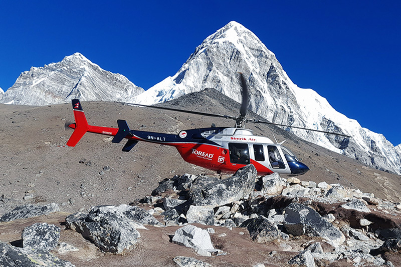
Everest Base Camp Helicopter Tour
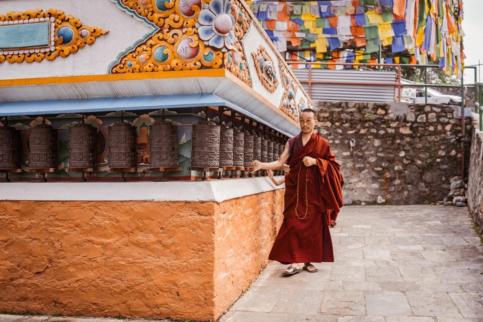
Monastery Stay Tour