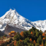
20 Best Treks in Nepal: The Definitive Guide for Every Type of Trekker
Nepal doesn’t have a trekking problem. It has a choosing problem.
With more than 30 designated trekking corridors, eight of the world’s fourteen 8,000-meter peaks, and trail networks that range from five-day foothills walks to three-week wilderness expeditions deep into restricted territory near the Tibetan border, the hardest part of planning a Nepal trek isn’t getting there. It’s deciding which version of Nepal you want to walk through.
This guide covers 20 of the best trekking routes in Nepal, organized by what each one actually delivers, not just its altitude and duration. From the world-famous Everest Base Camp trail to routes that barely appear on mainstream trekking maps, every trek here earns its place for specific, verifiable reasons.
How to Use This Guide
Each trek is presented with honest difficulty assessment, best season, approximate duration, maximum altitude, and what distinguishes it from the hundred other routes competing for the same two weeks of your annual leave. Read the whole list before deciding. The trek that’s right for you is rarely the most famous one. It’s the one that fits your fitness, your timeline, your risk tolerance, and the kind of mountain experience you actually want.
Quick Reference: 20 Best Nepal Treks at a Glance
| Trek | Duration | Max Altitude | Difficulty | Region |
|---|---|---|---|---|
| Everest Base Camp | 14-15 days | 5,545m | Moderate | Khumbu |
| Manaslu Circuit | 13-16 days | 5,106m | Moderate-Hard | Manaslu |
| Annapurna Circuit | 15-18 days | 5,416m | Moderate | Annapurna |
| Annapurna Base Camp | 10-12 days | 4,130m | Moderate | Annapurna |
| Everest Three Passes | 18-21 days | 5,535m | Hard | Khumbu |
| Gokyo Lakes | 12-14 days | 5,360m | Moderate | Khumbu |
| Ghorepani Poon Hill | 5-9 days | 3,210m | Easy | Annapurna |
| Langtang Valley | 7-10 days | 3,870m | Easy-Moderate | Langtang |
| Tamang Heritage | 8-10 days | 3,700m | Easy-Moderate | Langtang |
| Upper Mustang | 14-16 days | 3,840m | Moderate | Mustang |
| Nar Phu Valley | 14-18 days | 5,320m | Hard | Annapurna |
| Mardi Himal | 7-10 days | 4,500m | Moderate | Annapurna |
| Pikey Peak | 8-10 days | 4,065m | Easy-Moderate | Solu Khumbu |
| Tsum Valley | 14-18 days | 3,700m | Moderate | Manaslu |
| Makalu Base Camp | 18-21 days | 5,800m | Hard | Eastern Nepal |
| Kanchenjunga Circuit | 21-25 days | 5,143m | Hard | Eastern Nepal |
| Dhaulagiri Circuit | 18-21 days | 5,360m | Very Hard | Annapurna |
| Upper Dolpo | 21-25 days | 5,190m | Very Hard | Western Nepal |
| Shey Phoksundo Lake | 10-12 days | 3,612m | Moderate | Dolpo |
| Rolwaling Valley | 14-17 days | 4,600m | Hard | Rolwaling |
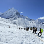
1. Everest Base Camp Trek
Duration: 14-15 days
Max Altitude: 5,545m (Kala Patthar)
Difficulty: Moderate
Best Season: March-May, October-November
The most famous trekking route on earth needs no introduction, but it does need honest context. Everest Base Camp doesn’t summit Everest. It walks to the foot of it, through the Khumbu region of northeastern Nepal, past Sherpa villages, Buddhist monasteries, and one of the most dramatic mountain landscapes on the planet.
The route begins with a short flight from Kathmandu to Lukla at 2,860 meters, one of the most photographed airport runways in the world for good reason given its length and its drop-off at one end. From Lukla, the trail moves north through Phakding, Namche Bazaar, Tengboche, Dingboche, and Lobuche before reaching Gorak Shep and the final push to Base Camp at 5,364 meters and Kala Patthar at 5,545 meters.
Namche Bazaar at 3,440 meters is the commercial and cultural hub of the Khumbu. The Saturday market draws traders from across the region. The bakeries and espresso machines are a genuine surprise. The acclimatization day here is built into every responsible itinerary for good reason, and the hike up to the Everest View Hotel above town delivers the first unobstructed view of Everest’s south face alongside Lhotse, Ama Dablam, and Thamserku in a single panorama.
Tengboche Monastery at 3,867 meters, perched on a ridge above the confluence of two glacial valleys, is the spiritual anchor of the entire route. The monastery hosts the Mani Rimdu festival in November, a three-day ceremony involving masked dances and rituals that draws local communities from across the Khumbu. Walking through its gate in the early morning with Ama Dablam filling the sky behind the main temple building is not something that photographs fully capture.
The terrain above Dingboche at 4,410 meters becomes increasingly austere. The rhododendron forests give way to high-altitude scrub, then bare moraine. Lobuche at 4,940 meters is where the altitude starts imposing itself on trekkers who haven’t taken acclimatization seriously. Gorak Shep at 5,140 meters, the final settlement before Base Camp, sits on a frozen lake bed surrounded by glacial debris.
Kala Patthar, the black rock shoulder of Pumori that rises above Gorak Shep, delivers the signature view. Everest’s summit pyramid, the Khumbu Icefall, and the full upper Khumbu glacier system spread out in a single unobstructed panorama that justifies every step of the two weeks to get there.
What distinguishes EBC from every other high-altitude route in Nepal is the infrastructure. The Khumbu has the most developed tea house network in the Himalayas. Lodges at Namche run solar-heated showers and cappuccino machines. The trail is well-marked, permit checkpoints are consistent, and emergency services including helicopter evacuation are readily accessible. First-time high-altitude trekkers are in the right place.
What makes it essential: The combination of mountain scale, Sherpa cultural depth, and trail infrastructure makes this the reference standard for Himalayan trekking worldwide.
What to know: October fills this route to capacity. November offers identical views with noticeably fewer people. Avoid compressing the itinerary. Altitude sickness at Lobuche and Gorak Shep is common among trekkers who rushed the acclimatization profile.
2. Manaslu Circuit Trek
Duration: 13-16 days
Max Altitude: 5,106m (Larkya La)
Difficulty: Moderate-Hard
Best Season: March-May, September-November
The Annapurna Circuit built its reputation over decades. The Manaslu Circuit is what the Annapurna Circuit used to feel like before road construction and mass tourism changed it. Same mountain scale, same cultural variety, same high-pass crossing drama. Different crowd equation entirely.
The circuit circumnavigates Manaslu, the world’s eighth-highest mountain at 8,163 meters, through the Nubri and Tsum valleys along the Budigandaki River gorge. The terrain shifts from subtropical lowland forests near the trailhead at Sotikhola through rhododendron and bamboo forest, high alpine pasture, and finally the barren high-altitude landscape approaching Larkya La Pass.
The Budigandaki Gorge section is one of the most dramatic trail environments in Nepal. The river has carved a canyon so narrow that the trail at points clings to cliff faces on wooden bridges, moving through a corridor of vertical rock with the river roaring far below. It’s not technically difficult, but the exposure is real.
Samagaon at 3,520 meters and Samdo at 3,875 meters are the cultural high points of the circuit. These Tibetan-influenced villages near the Tibet border have maintained their character in ways that lower-altitude trail communities on busier routes haven’t. The stone houses, chortens, and active monasteries here belong to communities that have lived at altitude for generations. The yak herds in the high meadows above Samdo in autumn are working animals, not tourist attractions.
Larkya La at 5,106 meters is the circuit’s defining moment. The crossing begins before dawn, typically around 4 am from Dharamsala High Camp, and the ascent gains 600 meters through moraine and snow before reaching the pass. The descent to Bhimthang on the far side drops 1,400 meters through a glacial valley with Manaslu’s north face filling the western sky.
The restricted area permit requirement limits daily trekker numbers and keeps the circuit substantially quieter than comparable routes. In peak October season, the Manaslu Circuit sees perhaps 15 to 20 percent of the daily foot traffic of the Annapurna Circuit. In September or November, sections of the trail feel genuinely remote.
What makes it essential: The Budigandaki Gorge, the Larkya La crossing, and communities near the Tibet border that haven’t been reshaped by three decades of mainstream trekking traffic.
What to know: Restricted area permits require booking through a registered agency. Manaslu permit costs vary seasonally, running USD 75 per week in September and USD 100 per week in October. The circuit is one-directional by convention, moving counterclockwise.
3. Annapurna Circuit Trek
Duration: 15-18 days
Max Altitude: 5,416m (Thorong La)
Difficulty: Moderate
Best Season: March-May, October-November
No trekking route in Nepal, possibly in the world, covers as much geographic and cultural ground in a single itinerary. The Annapurna Circuit loops around the entire Annapurna massif, beginning in the subtropical lowlands near Besisahar and emerging on the far side of Thorong La Pass into the wind-scoured Mustang plateau.
The altitude gain is a story in itself. The trail starts below 1,000 meters in rice paddy territory and reaches 5,416 meters at Thorong La, then descends 1,600 meters to Muktinath in a single long day. Between those two points, you walk through Gurung villages, Manangi communities with distinct trade-route history, and Thakali settlements in the Kali Gandaki Gorge, the deepest river gorge on earth by the metric of the elevation difference between the adjacent peaks of Dhaulagiri and Annapurna and the river running between them.
Manang at 3,519 meters is the circuit’s most interesting mid-point. The acclimatization day here is an opportunity rather than a rest. The hike to Tilicho Lake, a glacial lake at 4,919 meters considered the highest lake of its size in the world, is a full-day side trip that most circuit trekkers skip for reasons that are difficult to justify once you’ve seen it. The lake sits in a moraine bowl ringed by the Tilicho and Annapurna peaks, with a color that shifts between turquoise and steel-grey depending on cloud cover and time of day.
Thorong La crossing day is the circuit’s defining physical challenge. The standard approach involves sleeping at Thorong Phedi High Camp at 4,600 meters and departing at 4 to 5 am. The ascent climbs 800 meters in roughly four hours on a steep, rocky trail that offers no technical difficulty but punishes any lack of acclimatization with extreme effectiveness. The descent to Muktinath is long, steep, and rewarding.
Muktinath at 3,800 meters is one of the most significant pilgrimage sites in the Himalayas for both Hindus and Buddhists. The temple complex includes 108 stone water spouts around the main shrine, each feeding water from the Himalayan aquifer, and a site where natural gas seeps produce a flame through water, the eternal flame that gives the site its particular religious significance.
The Kali Gandaki section from Jomsom to Tatopani descends through the deepest gorge in the world past Thakali villages known for their food and apple orchards, hot springs at Tatopani, and the extraordinary red and ochre rock formations of the upper Mustang approach.
What makes it essential: The geographic and cultural range compressed into a single route is unmatched in Nepal. From monsoon lowlands to high desert plateau in two weeks, through communities that have managed trade routes across this terrain for centuries.
What to know: Road construction has shortened the circuit’s traditional lower sections. The lower Marsyangdi valley walk is now largely replaced by road transfer. This reduces total walking days but eliminates some of the early-circuit character. Start from Jagat or Chamje to preserve the best trekking sections.
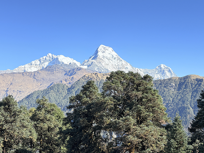
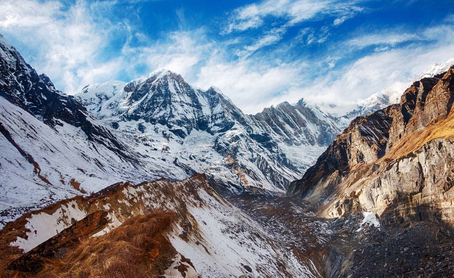
4. Annapurna Base Camp Trek
Duration: 10-12 days
Max Altitude: 4,130m
Difficulty: Moderate
Best Season: March-May, October-November
Where the Annapurna Circuit gives you breadth, the ABC Trek gives you depth. Literally. The route walks directly into the Annapurna Sanctuary, a glacial amphitheater enclosed by some of the highest mountains in the Himalayas, until the valley walls rise so steeply that the sky above is reduced to a strip of blue.
The approach from Pokhara moves through Gurung villages including Ghandruk, one of the best-preserved traditional Gurung settlements in Nepal, with stone houses, slate roofs, and community infrastructure that dates back generations. The Gurung people have historically provided a disproportionate share of Nepal’s Gurkha soldiers, and the culture here carries that history in the directness and hospitality of the communities.
The trail through the Modi Khola valley to Base Camp passes through sections of bamboo and rhododendron forest that in spring are improbably green and in autumn carry a dry forest smell that combines with the cold air from the glaciers above into something that doesn’t translate into description particularly well.
Machhapuchhre Base Camp at 3,700 meters sits below the unclimbed south face of Machhapuchhre, the “fishtail” peak that defines the Pokhara skyline from 60 kilometers away. The mountain has been closed to climbing since 1964 out of religious significance to local communities. Viewed from its own base camp at dawn, it fills the frame in a way that technically climbed mountains somehow don’t.
Annapurna Base Camp at 4,130 meters is the amphitheater’s center point. The surrounding walls include Annapurna I at 8,091 meters, the world’s tenth-highest peak, Annapurna South, Hiunchuli, Machhapuchhre, Annapurna III, and Gangapurna. The circular panorama from the center of this basin is the kind of mountain view that makes experienced trekkers go quiet.
What makes it essential: The sanctuary’s enclosed topography creates a visual intensity that open-horizon viewpoints don’t replicate. You’re standing inside the mountain range rather than looking at it from outside.
What to know: The Modi Khola valley narrows significantly above Dovan. The confined gorge can avalanche after heavy snow. Spring and autumn clear this risk but not eliminate it. A guide with current conditions knowledge matters on this route.
5. Everest Three Passes Trek
Duration: 18-21 days
Max Altitude: 5,535m (Kongma La)
Difficulty: Hard
Best Season: March-May, October-November
The standard EBC route takes you to the foot of the world’s highest mountain. The Three Passes Trek takes you over three of the Khumbu’s high ridgelines, through valleys the EBC route never touches, and delivers a depth of Khumbu experience that the well-worn main trail simply cannot provide.
The three passes are Kongma La at 5,535 meters, Cho La at 5,420 meters, and Renjo La at 5,340 meters. Each sits above a different glacial valley and connects different sections of the Khumbu in a loop that visits Gokyo on the western side and the Everest Base Camp approach on the eastern side.
Cho La is the most technically demanding of the three. The eastern side of the pass involves a short glacier crossing where ice and snow conditions vary by season and require either crampons or careful route-finding through rocky sections that bypass the worst of the ice. It’s not mountaineering, but it’s the kind of terrain that distinguishes experienced trekkers from those who signed up for EBC and got talked into an upgrade.
The Gokyo Lakes, a chain of six glacial lakes in the valley west of Everest, are the western circuit’s anchor. Gokyo Ri at 5,360 meters above the third lake delivers what many experienced Khumbu trekkers consider the finest single viewpoint in the region: Everest, Lhotse, Makalu, and Cho Oyu, four of the world’s six highest peaks, visible simultaneously from a single vantage point.
The Ngozumpa Glacier, Nepal’s largest glacier running between Gokyo and Cho La, is a study in glacial geology at a scale that makes the scale of Himalayan forces impossible to intellectualize away. Walking alongside it in the early morning with the peaks above reflecting first light is one of those unrepeatable trekking experiences.
What makes it essential: The only way to see the Khumbu comprehensively rather than from a single approach corridor. The views from Gokyo Ri and Renjo La rival or exceed Kala Patthar with a fraction of the accompanying crowd.
What to know: This is a hard trek. Three passes above 5,300 meters require solid fitness, proper acclimatization, and the right weather window. A guide with Three Passes experience is not optional on this route.
6. Gokyo Lakes Trek
Duration: 12-14 days
Max Altitude: 5,360m (Gokyo Ri)
Difficulty: Moderate
Best Season: March-May, October-November
The quieter alternative to EBC in the same Khumbu region. The Gokyo route branches west from the main EBC trail at Namche, following the Dudh Koshi River into the Gokyo Valley rather than continuing east toward Lobuche. The result is a route that reaches comparable altitudes, passes through equally dramatic Sherpa cultural territory, and delivers the Gokyo Ri viewpoint with less foot traffic than Kala Patthar on a busy October day.
The Gokyo Valley above the second lake enters a silence that the main EBC corridor doesn’t achieve. The Ngozumpa Glacier’s lateral moraines create an otherworldly landscape on the eastern valley wall. The lakes themselves, fed by glacial melt and carrying a mineral-derived turquoise color, are sacred in local Sherpa cosmology and off-limits for swimming or fishing.
The fourth and fifth lakes above Gokyo village require an additional day but reward the extension with views into the upper Cho Oyu approaches and a level of isolation that feels genuinely remote even during peak season.
What makes it essential: The Gokyo Lakes and Gokyo Ri viewpoint in a less crowded format than the EBC main trail, with the option to combine with the Three Passes route for a longer circuit.
What to know: Can be combined with EBC via Cho La Pass for the Three Passes experience. Or completed as a standalone out-and-back for a shorter, more focused Khumbu trip.
7. Ghorepani Poon Hill Trek
Duration: 5-9 days
Max Altitude: 3,210m (Poon Hill)
Difficulty: Easy
Best Season: March-May, September-November
Nepal’s best entry-level trekking route and one of the most photographically satisfying anywhere in the Himalayas at any difficulty level. The Poon Hill trek stays below 3,300 meters, keeps altitude sickness risk minimal, and delivers a sunrise panorama from the Poon Hill viewpoint tower that includes Dhaulagiri at 8,167 meters, Annapurna I at 8,091 meters, Machhapuchhre, Annapurna South, and Hiunchuli in a single unobstructed sweep.
The trail moves through Gurung villages in the Modi Khola valley, ascending through rhododendron forest to Ghorepani at 2,874 meters before the final push to Poon Hill at 3,210 meters. The forest between Ulleri and Ghorepani is the route’s unexpected highlight for many trekkers. In March and April, the rhododendrons are in full bloom. In September and October, the forest carries maximum canopy density in a deep, saturated green that the dry season never produces. The ascent of more than 3,000 stone steps at Ulleri is the route’s only genuinely demanding section.
The Gurung and Magar villages along the trail have maintained a genuine rural character. Ghandruk in particular, with its stone-paved lanes and traditional slate-roofed houses, is one of the best-preserved traditional Gurung settlements in the Annapurna region. The community-run Annapurna Conservation Area Project has been active here for decades and shows in both the trail maintenance and the cultural preservation.
What makes it essential: Maximum visual impact for minimum altitude and duration commitment. The right choice for first-time Nepal trekkers, families with older children, trekkers with limited time, and anyone who wants to understand why Nepal’s mountains are considered among the most beautiful in the world.
What to know: Poon Hill is crowded at sunrise in October. Arrive at the viewpoint before 5:30 am or accept company. The trail from Tadapani to Ghandruk and back to Nayapul extends the circuit by a day and adds significantly to the cultural experience.
8. Langtang Valley Trek
Duration: 7-10 days
Max Altitude: 3,870m (Kyanjin Gompa)
Difficulty: Easy-Moderate
Best Season: March-May, September-November
Kathmandu to trailhead in four hours by road. The Langtang Valley is Nepal’s most accessible mountain trekking destination and one of its most underrated. The route follows the Langtang River north from Syabrubesi through bamboo forests, rhododendron woodland, and Tamang villages before opening into the high-altitude valley below Kyanjin Gompa.
The valley was severely damaged in the 2015 earthquake, which triggered a rock and ice avalanche that buried the village of Langtang under meters of debris. The rebuilt Langtang Village and the restored lodges and trails reflect both the resilience of the Tamang communities and the importance the trekking economy holds for high mountain populations. Trekking here is one of the more direct ways to support communities that are still rebuilding.
Kyanjin Gompa at 3,870 meters is the route’s end point for most trekkers, though the valley continues into high pasture above the gompa. The cheese factory here, run by a Swiss development program established in the 1950s and still operating, produces yak cheese that has become a legitimate regional product sold in Kathmandu specialty shops. Buying it here, from the source, costs a fraction of the Thamel price.
Kyangin Ri above the gompa at approximately 4,773 meters provides one of the finest views in the Langtang region: Langtang Lirung at 7,227 meters directly above, the Tibetan plateau visible to the north, and the full Langtang Himalayan range spread east and west.
What makes it essential: Proximity to Kathmandu, genuine mountain access, Tamang cultural depth, and a trek that contributes directly to earthquake-affected community recovery.
What to know: Can be extended to Gosainkunda Sacred Lakes at 4,380 meters with an additional three days, combining high-altitude lake scenery with religious significance for both Hindu and Buddhist pilgrims.
9. Tamang Heritage Trek
Duration: 8-10 days
Max Altitude: 3,700m
Difficulty: Easy-Moderate
Best Season: March-May, September-November
Nepal’s trekking landscape tends toward mountain-focused routes where cultural experience is a secondary benefit to altitude and views. The Tamang Heritage Trek inverts that priority. Starting from Syabrubesi, the same trailhead as Langtang Valley, this route loops north through a series of Tamang villages that have maintained their Tibetan Buddhist culture with a consistency that the more visited trails haven’t preserved.
The Tamang people are one of Nepal’s largest ethnic groups, with a history tied to both Tibetan trade routes and the political complexities of Nepal’s border regions. Their villages in this northern corridor near Rasuwagadhi fort, the historical Nepal-Tibet trade gateway, retain practices that connect them to that longer history in ways that daily life in Kathmandu and even the more visited trekking communities have moved away from.
Homestays are available throughout the route in communities that have been specifically developed for cultural immersion rather than high-volume tea house trekking. Spending an evening in a Tamang household, sharing a meal of dhindo, gundruk, and local fermented potato alcohol, while understanding something of the family’s relationship to the monastery above the village, provides access to Himalayan life that the main trekking corridors don’t offer.
The route connects to the Langtang Valley Trek for trekkers who want to combine cultural immersion with mountain landscape in a single itinerary.
What makes it essential: The deepest cultural access of any route in the Langtang region, in communities that maintain their Tibetan Buddhist heritage with genuine authenticity rather than tourist-facing performance.
What to know: The Tamang Heritage route suits trekkers who prioritize cultural experience over altitude achievement. It’s not a physically demanding route, but the homestay accommodation requires comfort with basic facilities.
10. Upper Mustang Trek
Duration: 14-16 days
Max Altitude: 3,840m (Lo Manthang)
Difficulty: Moderate
Best Season: March-November (rain shadow region)
Upper Mustang is Nepal’s most geographically anomalous trekking destination. Sitting in the rain shadow of the Annapurna and Dhaulagiri ranges, it receives almost no monsoon precipitation while the rest of Nepal drowns for four months. The result is a high-altitude desert plateau that looks more like the Tibetan plateau than anything else in Nepal, because geographically and culturally it largely is.
The walled city of Lo Manthang at 3,840 meters, the former capital of the Kingdom of Mustang, is the route’s centerpiece. The city walls are intact. The monasteries inside the walls, including Jampa Lhakhang, Tubchen Gompa, and Chode Gompa, date to the 15th century and contain religious artwork and manuscripts that represent some of the best-preserved examples of medieval Tibetan Buddhist culture anywhere in the world. The Lo Manthang monastery restoration project, supported by the American Himalayan Foundation, has been working to preserve these structures for decades.
The landscape between Jomsom and Lo Manthang is red, ochre, and brown sandstone carved by wind and water into formations that erode faster than they can be photographed. Ancient cave systems in the cliffs throughout the upper Kali Gandaki valley, including the famous Sky Caves of Mustang, were occupied by humans for millennia and contain artifacts and human remains that archaeologists are still working to understand.
The restricted area permit at USD 500 for the first ten days reflects the region’s protected status. It’s the most expensive trekking permit in Nepal and the most justified. The cultural integrity that the restriction has helped preserve makes the comparison with an Annapurna Circuit ticket meaningless.
What makes it essential: Lo Manthang’s medieval architecture and living Buddhist culture, the Mustang landscape that belongs to no other trekking category, and year-round trekking accessibility that no other high-altitude Nepal route provides.
What to know: Jeep roads now reach Lo Manthang, which has changed the character of some sections. Trek the full route on foot from Jomsom to experience it properly.
11. Nar Phu Valley Trek
Duration: 14-18 days
Max Altitude: 5,320m (Kangla Pass)
Difficulty: Hard
Best Season: March-May, September-November
Hidden behind a narrow gorge entrance off the Annapurna Circuit route north of Koto, the Nar Phu Valley is what the word “remote” actually means in the context of Nepal trekking. The two villages of Nar and Phu are inhabited year-round by Tibetan-descended communities that maintained their isolation partly by geography, the gorge entrance is genuinely easy to walk past without noticing, and partly by the restricted area permit requirement that has kept casual visitor numbers low.
The approach through the Nar Phu gorge is one of the most dramatic trail environments in Nepal. The canyon walls close in to the point where the trail becomes a series of ledge traverses above the roaring Phu Khola, with vertical rock faces above and below. Emerging from the gorge into the upper valley feels like arriving in a different country entirely, which in cultural terms it almost is.
Phu village at 4,080 meters is the valley’s deepest settlement, surrounded by the Himlung Himal, Kang Guru, and Ratna Chuli peaks. The village’s gompa, perched above the settlement on a rock promontory, is still actively used by the community’s monks. The stone houses and traditional architecture here date back generations in a form of construction that has been maintained rather than modernized.
The Kangla Pass at 5,320 meters connects Nar Phu to the main Annapurna Circuit, allowing the valley to be incorporated into a circuit itinerary for trekkers who want to enter via the gorge and exit over the high pass or vice versa.
What makes it essential: The most intact traditional mountain community culture accessible by foot in the Annapurna region, in a landscape that has been protected from mass tourism by both geography and permit restriction.
What to know: This route requires a guide with specific Nar Phu experience. The gorge sections in poor conditions require careful navigation. Not suitable for trekkers without prior high-altitude experience.
12. Mardi Himal Trek
Duration: 7-10 days
Max Altitude: 4,500m (High Camp)
Difficulty: Moderate
Best Season: March-May, September-November
Mardi Himal is the Annapurna region’s best-kept recent secret. The route was officially designated in 2012 and has been gaining recognition among experienced Nepal trekkers who want Annapurna views without the Poon Hill crowds or the commitment of the full circuit.
The trail climbs the ridge east of the Modi Khola valley, following a spur toward Mardi Himal peak at 5,587 meters through forest camps and rhododendron ridgelines. The approach through Low Camp and Forest Camp to High Camp at approximately 4,500 meters puts Machhapuchhre’s unclimbed south face at genuinely close range, with Annapurna South and Hiunchuli filling the western skyline.
The ridge walk between Forest Camp and High Camp is the route’s defining section. The trail runs along a narrow forested ridge with views opening on both sides, the Modi Khola valley dropping steeply to the west, the Mardi Himal glacier approaches rising to the east. In October and November, the rhododendrons along this section have turned burgundy and gold. In March and April, they’re in full flower.
What makes it essential: Close-range Annapurna views on a trail that hasn’t yet absorbed the crowd volume of neighboring routes. The ridge walk section is some of the best walking in the Annapurna region.
What to know: The route has developed rapidly since 2012 and lodge facilities are still improving. Book through a registered operator to confirm current accommodation conditions on the upper sections.
13. Pikey Peak Trek
Duration: 8-10 days
Max Altitude: 4,065m
Difficulty: Easy-Moderate
Best Season: March-May, October-November
Sir Edmund Hillary, who knew the Khumbu better than almost anyone, reportedly called Pikey Peak the finest viewpoint for Everest anywhere in Nepal. From the summit at 4,065 meters, the view takes in Everest, Lhotse, Makalu, Cho Oyu, Kanchenjunga, and the full Himalayan range from a vantage point that the standard Lukla-based routes don’t deliver.
The trek starts from Shivalaya in the lower Solu Khumbu, the same trailhead used by early Everest expeditions before the Lukla airstrip was built. The approach through Tamang and Sherpa villages in the lower Khumbu moves through terrain that is rarely visited because most trekkers fly directly to Lukla and bypass this entire section. What they miss is the cultural transition from Tamang Buddhist lowlands to Sherpa Buddhist highlands, which happens gradually here over several days rather than being skipped by a 30-minute flight.
Thupten Choling Monastery, a major Tibetan Buddhist institution near the route, is one of the most important monasteries in Nepal’s lower Khumbu and houses several hundred monks and nuns. The monastery complex includes active teaching institutions and a community that maintains Tibetan Buddhist scholarship in a form that Kathmandu’s tourist-oriented gompa visits don’t provide access to.
What makes it essential: The Everest viewpoint that Hillary preferred, in a section of the Khumbu that the flight-to-Lukla trekking model has rendered invisible to most visitors.
What to know: The lower Solu Khumbu trails are less well-marked than the main Khumbu corridor. A guide familiar with this route is particularly useful here.
14. Tsum Valley Trek
Duration: 14-18 days
Max Altitude: 3,700m
Difficulty: Moderate
Best Season: March-May, September-November
The Tsum Valley remained closed to foreign trekkers until 2008. That closure preserved something that the more accessible valleys have lost: a Tibetan Buddhist culture that has evolved in genuine isolation rather than adapting to the expectations of outside visitors. The valley sits in the Manaslu region near the Tibet border, seven hours’ drive from Kathmandu, but in cultural terms it might as well be a different century.
The name Tsum comes from the Tibetan word for “vivid” or “clear,” which describes both the landscape clarity at altitude and something harder to define about the quality of life that manages to persist here. Milarepa, one of Tibetan Buddhism’s most significant saints, is said to have meditated in caves throughout the valley. Those caves are marked and still visited by pilgrims from across the Buddhist world.
The monasteries along the route include Mu Gompa and Rachen Gompa, both active institutions with resident monk and nun communities. The mani walls, prayer flags, and chortens throughout the valley aren’t decorative. They’re functional elements of a living religious community that hasn’t been simplified for tourist consumption.
Manaslu, Himalchuli at 7,893 meters, and Ganesh Himal at 7,140 meters provide the mountain backdrop. The combination of high-mountain scenery and intact cultural depth on a single route is rare in Nepal. The Tsum Valley delivers it in a format that requires effort to access, which is much of why it remains what it is.
What makes it essential: The most intact Tibetan Buddhist cultural environment accessible by trekking in Nepal, in a valley that barely existed on mainstream trekking maps fifteen years ago.
What to know: Can be combined with the Manaslu Circuit for an extended itinerary. The restricted area permit applies. Restricted permits require booking through a registered agency.
15. Makalu Base Camp Trek
Duration: 18-21 days
Max Altitude: 5,800m
Difficulty: Hard
Best Season: March-May, October-November
Makalu, the world’s fifth-highest mountain at 8,485 meters, gets a fraction of the attention of Everest and Annapurna. The trekking route to its base camp reflects that: long, technically demanding, traversing some of Nepal’s most beautiful and least-visited terrain in the far east of the country. Eric Shipton first explored this area in the 1950s, and sections of the route still feel like the 1950s in the best possible sense.
The approach passes through Makalu-Barun National Park, one of Nepal’s most biodiverse protected areas. The park protects habitat from 435 meters above sea level to Makalu’s summit, encompassing subtropical, temperate, subalpine, and alpine ecosystems in a single protected zone. Red panda, snow leopard, and musk deer all inhabit different altitude bands within the park. The rhododendron forests between 2,500 and 3,500 meters are among the finest in Nepal.
The final approach to Base Camp at approximately 4,870 meters involves crossing several high passes on a route that Shipton described as among the finest mountain approaches he had encountered. The view from above Base Camp takes in Everest’s east face, known as the Kangshung Face, alongside Lhotse, Baruntse at 7,129 meters, and Chamlang at 7,319 meters.
What makes it essential: The combination of exceptional biodiversity, genuine remoteness, and a mountain landscape at the base camp that rivals anything in Nepal without the EBC infrastructure and crowds.
What to know: This trek requires camping for sections of the route. Full camping support through a reputable operator is not optional. The eastern Nepal trail infrastructure is significantly less developed than the Khumbu or Annapurna corridors.
16. Kanchenjunga Circuit Trek
Duration: 21-25 days
Max Altitude: 5,143m (Sele La)
Difficulty: Hard
Best Season: March-May, October-November
Kanchenjunga, the world’s third-highest mountain at 8,586 meters, guards Nepal’s far northeastern border with India and Sikkim. The circuit trek visits both the North Base Camp at 5,143 meters and the South Base Camp at 4,786 meters in a route that constitutes one of the longest and most demanding established treks in Nepal.
The approach through the Taplejung district moves through a Nepal that most trekkers never reach. The cultural mosaic here is different from the Sherpa-and-Tamang dominated west: Limbu, Rai, and Yamphu communities occupy the lower valleys in a ethnic and linguistic landscape that eastern Nepal specialists study and mainstream trekkers almost never engage with.
The Kanchenjunga Conservation Area, established in 1997, protects the forest corridors and high-altitude habitat of this corner of Nepal with a biodiversity record that includes 16 species of rhododendron, 69 orchid species, red panda, snow leopard, clouded leopard, and the endangered musk deer. The wildlife encounter probability on this route, particularly for red panda in the forest sections between 2,500 and 4,000 meters, is among the highest of any Nepal trek.
The views from the North Base Camp, looking at the Kanchenjunga massif from below its northern glacier system, are in a category of mountain experience that the more accessible routes cannot replicate.
What makes it essential: The third-highest mountain in the world from its own base camp, in Nepal’s most biodiverse trekking region, on trails that see perhaps two percent of the Khumbu’s annual visitor volume.
What to know: The long approach to eastern Nepal by road or flight requires careful itinerary planning. This is a serious commitment of time and fitness. Not appropriate as a first Nepal trek.
17. Dhaulagiri Circuit Trek
Duration: 18-21 days
Max Altitude: 5,360m (French Pass)
Difficulty: Very Hard
Best Season: April-May, October
Dhaulagiri at 8,167 meters is the world’s seventh-highest mountain. The circuit trek around it is among the most demanding non-technical treks in Nepal, involving two high passes above 5,000 meters, multiple nights camped above 5,000 meters, and sections of terrain that cross glacial moraines and snowfields requiring careful navigation.
The French Pass at 5,360 meters and the Dhampus Pass at 5,244 meters are the circuit’s defining crossings. The Hidden Valley between them, at approximately 5,000 meters, is one of Nepal’s most surreal trekking environments: a high-altitude plateau ringed by Dhaulagiri’s satellite peaks, completely isolated, and traversed on a route where the nearest support infrastructure is a long way in either direction.
The optional ascent of Dhampus Peak at 6,060 meters requires crampons, ice axe, and basic mountaineering competence but rewards it with a summit view that connects the Annapurna, Dhaulagiri, and Mustang ranges in a single panorama.
Marpha village near the circuit’s conclusion in the Kali Gandaki Valley is famous for its apple orchards and locally produced apple brandy, which the village’s Thakali community has been making for generations. It’s the kind of unexpected specific pleasure that a three-week hard trek deserves at the end.
What makes it essential: The Hidden Valley experience and the Dhaulagiri massif from base camp level, in a route that demands serious trekking credentials and rewards them proportionally.
What to know: This is a camping trek. Full camping and kitchen support is required. Several days above 5,000 meters demand solid high-altitude acclimatization before the circuit’s high sections.
18. Upper Dolpo Trek
Duration: 21-25 days
Max Altitude: 5,190m (Kang La)
Difficulty: Very Hard
Best Season: May-June, September-October
Dolpo, in Nepal’s far northwest between the Tibetan plateau and the Dhaulagiri range, was closed to foreigners until 1989. Upper Dolpo, the more remote northern section, requires a special restricted area permit and remains one of the least-visited trekking destinations in the Himalayas. Peter Matthiessen’s book “The Snow Leopard” and Eric Valli’s film “Himalaya” introduced Dolpo to the outside world. The physical reality of being there is different from both.
The landscape is arid, wind-sculpted, and vast in the way that high-altitude desert regions are vast: distances that look navigable from a ridge take two days to cross. The rivers run fast and cold from Tibetan plateau snowmelt. The villages cling to south-facing slopes where the growing season is short enough to require every available square meter of cultivable ground.
Phoksundo Lake at 3,612 meters, Nepal’s deepest lake and one of its most beautiful, sits in the middle of the Upper Dolpo approach. The lake’s color shifts between deep turquoise and midnight blue depending on cloud cover, and the 330-meter Phoksundo Waterfall that feeds it is one of the tallest in Nepal.
Shey Gompa, the Crystal Monastery at 4,390 meters, is the spiritual center of the Bon-influenced Buddhist culture of Upper Dolpo. The monastery sits below a crystal-quartz mountain face and remains an active pilgrimage destination for Bonpo practitioners from across the Himalayan Buddhist world.
What makes it essential: The most genuinely remote and culturally distinct trekking destination in Nepal. Nothing else in the country looks like Dolpo, and nothing else preserves its particular form of Bon-influenced Himalayan culture.
What to know: Upper Dolpo is a camping trek requiring full expedition support. The restricted area permit is USD 500 for the first 10 days in Upper Dolpo proper. Budget and logistics for this route require serious planning through an experienced operator.
19. Shey Phoksundo Lake Trek
Duration: 10-12 days
Max Altitude: 3,612m
Difficulty: Moderate
Best Season: May-June, September-October
For trekkers drawn to Dolpo but unable to commit three-plus weeks to Upper Dolpo, the Phoksundo Lake Trek provides access to the region’s most celebrated natural feature in a shorter, more accessible format. The route reaches Phoksundo Lake without crossing the high passes that define the Upper Dolpo expedition.
The approach through the Shey Phoksundo National Park moves through a landscape that transitions from subtropical forest near Dunai to high-altitude conifer woodland and then to the semi-arid terrain that characterizes the Dolpo approach. The national park is one of Nepal’s richest wildlife habitats, protecting populations of snow leopard, Himalayan blue sheep, Himalayan tahr, musk deer, and the Tibetan wolf.
The lake itself, sacred to both Buddhist and Bonpo practitioners, sits in a natural bowl at 3,612 meters with the Kanjirowa Himal range at 6,612 meters forming its northern backdrop. The village of Ringmo beside the lake is one of the best-preserved examples of traditional Dolpo architecture and community structure, with houses and storage structures that have been maintained in essentially the same form for generations.
Tshowa Gompa, a 900-year-old Bonpo monastery above Ringmo village, predates Tibetan Buddhism’s arrival in the region and represents a religious tradition that has been practiced continuously in this valley longer than many world religions have existed.
What makes it essential: Phoksundo Lake and the Bonpo cultural landscape of Dolpo in a format accessible to trekkers without the fitness, time, or budget for the full Upper Dolpo expedition.
What to know: No high passes on this route. The main challenge is the approach distance. Helicopter access to Juphal reduces approach time significantly for trekkers with budget flexibility.
20. Rolwaling Valley Trek
Duration: 14-17 days
Max Altitude: 4,600m
Difficulty: Hard
Best Season: March-May, October-November
Tucked between the Langtang region to the west and the Everest region to the east, the Rolwaling Valley sits in a geographic and tourism gap that has preserved it in a form that neither neighbor has maintained. The valley runs east-west, protected on both sides by high ridgelines, and sees a fraction of the visitor numbers of either adjoining region.
The trail enters through the Gaurishankar Conservation Area, passing through Tamang villages that benefit from the valley’s relative isolation from mainstream trekking traffic. The high meadows above Bedding village and the approach to Tsho Rolpa Glacial Lake at 4,580 meters move through alpine terrain that combines the scale of the Khumbu with the quietness of a restricted-area route, without requiring a restricted-area permit.
Gaurishankar at 7,145 meters and Melungtse at 7,181 meters dominate the northern skyline above the upper valley. From Tsho Rolpa, the glacial lake that sits at the base of these peaks, the view encompasses some of Nepal’s most dramatic and least-photographed mountain scenery.
The Tamang communities managing the tea houses throughout the Rolwaling Valley have lived in relationship with this landscape for generations. The lodges are simple. The food is local. The conversation, if you approach it with curiosity rather than expectation, reveals a community relationship with the surrounding mountains that is different from the service-economy dynamic of the major trekking corridors.
The Tashi Lapcha Pass at 5,755 meters connects Rolwaling to the Khumbu’s Thame Valley for experienced trekkers with technical skills and the appropriate equipment. This crossing requires glacier travel and basic mountaineering competence and transforms the Rolwaling route into one of the great Himalayan traverse experiences for those equipped for it.
What makes it essential: The Rolwaling Valley delivers the geographic and cultural character that first drew trekkers to Nepal, in a format that the major corridors no longer offer because their own success changed them.
What to know: The upper valley tea house infrastructure is more basic than the major corridors. Prepare for simple accommodation and limited menu options above Bedding. The trail is less well-marked than EBC or Annapurna routes, making a guide familiar with Rolwaling significantly more useful here than on the main corridors.
How to Choose the Right Nepal Trek
Twenty treks cover a lot of ground. The following framework narrows it quickly.
By available time: Under 10 days: Ghorepani Poon Hill, Langtang Valley, Mardi Himal, Shey Phoksundo Lake 10-15 days: Everest Base Camp, Annapurna Base Camp, Gokyo Lakes, Manaslu Circuit, Upper Mustang 15-20 days: Annapurna Circuit, Everest Three Passes, Nar Phu Valley, Tsum Valley 20+ days: Makalu Base Camp, Kanchenjunga Circuit, Dhaulagiri Circuit, Upper Dolpo
By fitness and experience: First-time trekkers: Ghorepani Poon Hill, Langtang Valley, Tamang Heritage Moderate fitness, some trekking background: EBC, ABC, Annapurna Circuit, Gokyo Lakes, Upper Mustang Experienced, high fitness: Manaslu Circuit, Three Passes, Nar Phu, Mardi Himal, Rolwaling Expert, expedition background: Dhaulagiri Circuit, Upper Dolpo, Kanchenjunga Circuit, Makalu
By primary interest: Mountain views: EBC, Three Passes, Gokyo Ri, Mardi Himal, Pikey Peak Cultural immersion: Tamang Heritage, Upper Mustang, Tsum Valley, Nar Phu Remote wilderness: Dolpo, Kanchenjunga, Makalu, Rolwaling, Dhaulagiri Accessibility and efficiency: Ghorepani Poon Hill, Langtang Valley, Annapurna Base Camp
By season: Year-round options (rain shadow): Upper Mustang, Shey Phoksundo Lake Spring specialists: Annapurna Circuit, ABC (rhododendrons), Makalu (stable pre-monsoon) Autumn peak: All major routes, with October delivering maximum crowds and November delivering better solitude September opportunity: Langtang, Manaslu, Rolwaling, Nar Phu (late month)
Nepal Trekking Permits: What Every Route Requires
Since April 1, 2023, all foreign trekkers must hire a licensed guide through a government-registered agency when trekking in national parks, conservation areas, and restricted zones. The independent TIMS card for solo trekkers no longer exists.
Standard permits (all major routes):
- TIMS Card: NPR 2,000 for non-SAARC nationals, obtained through a registered agency
- National Park or Conservation Area Permit: USD 20-35 depending on region
Restricted area permits (additional requirement):
- Manaslu, Tsum Valley: USD 75-100 per week depending on season
- Upper Mustang, Upper Dolpo: USD 500 for first 10 days
- Nar Phu Valley: USD 75-90 per week
- All restricted routes require a licensed guide; enforced at multiple checkpoints
A Nepal Tourism Board-registered agency handles all permit documentation. Getaway Nepal Adventure, based in Thamel, Kathmandu, manages permits, licensed guides, porter arrangements, and full logistics for all 20 routes listed here. Their registration with TAAN and the Nepal Mountaineering Association means the documentation meets every checkpoint requirement on every route.
Best Trekking Seasons in Nepal: Quick Reference
Spring (March-May): Rhododendrons in full bloom. Warmer temperatures at altitude. Clear views through April, some pre-monsoon cloud building in May. Best for: Annapurna routes, lower altitude treks, routes with high floral interest.
Monsoon (June-August): Heavy rainfall on most routes. Best avoided except rain shadow regions: Upper Mustang, Dolpo, Nar Phu. Leeches and landslide risk on forested lower sections.
Autumn (September-November): Nepal’s primary trekking season. Post-monsoon clarity, stable weather, maximum visibility. September second half increasingly popular for its combination of near-autumn conditions and pre-peak crowds. October delivers peak conditions with peak crowds. November offers October’s views with November’s solitude.
Winter (December-February): Cold at all altitudes, very cold above 4,000 meters. Some high passes close. Quietest trails of the year. Lower altitude routes remain viable for properly equipped trekkers.
Nepal has 30-plus trekking routes for a reason. The Himalayas are big enough, complex enough, and culturally varied enough to sustain that variety without any single route being the only answer. The 20 treks in this guide cover every category of experience the country offers, from the world’s most famous mountain approach to valleys that most Nepali trekking guides have never walked.
The right trek is the one that matches where you are as a trekker with where Nepal can take you. That calculation is worth more than any top-ten list.
Recent Posts