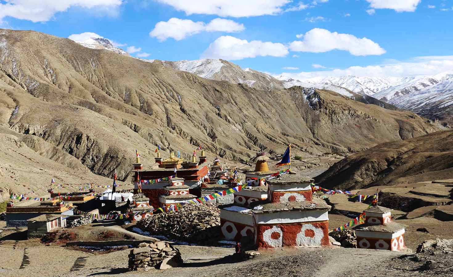
Nar Phu Valley Trekking
Nepal’s Most Rewarding Off-the-Beaten-Path Himalayan Journey
Nepal’s trekking map is dominated by a handful of legendary routes. Everest Base Camp, Annapurna Circuit, Langtang these names fill the bucket lists of millions of trekkers worldwide, and for good reason. But within the same mountain ranges that contain these famous trails, there are valleys that most trekkers walk right past without knowing they exist. The Nar Phu Valley is one of them.
Tucked into the northern reaches of the Manang District, directly above the Annapurna Circuit route, the Nar Phu Valley sits behind a restricted access gate at Koto that the vast majority of trekkers on the main trail never pass through. The two villages of Nar and Phu both positioned above 4,100 meters remained completely closed to foreign visitors until 2002. For decades before that, the valley functioned as an isolated high-altitude world on its own terms: Tibetan Buddhist culture intact, ancient trade routes still in use, landscapes shaped more by wind and altitude than by human development. The restricted area permit system introduced after 2002 kept visitor numbers deliberately low. That’s precisely why, more than two decades later, the Nar Phu Valley still looks and feels like what it actually is one of the last genuinely untouched trekking destinations in the entire Himalayas.
What Is the Nar Phu Valley Trek?
The Nar Phu Valley Trek is a restricted-area trek in the Annapurna region of northern Nepal, covering two remote villages of Phu and Nar set deep within a high-altitude valley that borders Tibet. The trail branches off the Annapurna Circuit at Koto (2,600 meters) and pushes north into terrain that shifts dramatically from river gorge and pine forest to barren, wind-sculpted cliffs, stone-built villages, and glacial valleys as you gain altitude.
The standard route runs between 10 and 14 days depending on the itinerary whether you’re doing a direct out-and-back from Koto, or crossing the Kang La Pass at 5,320 meters to rejoin the Annapurna Circuit at Ngawal near Manang. Most trekkers choose the Kang La Pass crossing, which gives the trek both a logical route structure and one of the most spectacular high-altitude pass experiences anywhere in Nepal. Some extend further by continuing over Thorong La Pass (5,416 meters) and completing the full Annapurna Circuit, turning the Nar Phu section into a remote gateway for one of Nepal’s great circular treks.
Trek Highlights
Phu Village — Nepal’s Highest Tibetan Settlement
Phu sits at approximately 4,080 meters at the head of the valley, directly below the glaciers of Himlung Himal (7,126 meters). The village is C-shaped in layout, clustered tightly around its monastery, with mud-brick houses stacked against the hillside in a style unchanged for centuries. The people of Phu are primarily Khampa Tibetan in heritage descendants of communities that used this valley as both a settlement and a refuge during periods of political upheaval across the border. Farming here is marginal at this altitude; most families depend on yak herding, local handicrafts, and increasingly, tourism, though visitor numbers remain small enough that the village hasn’t been reshaped by it.
Nar Village — The More Accessible
Hidden Gem Nar sits at 4,183 meters on a ridgeline above the valley, its terraced farmlands dropping south and its northern face opening onto high-altitude pastures where yak herds graze in summer. Compared to Phu, Nar is slightly more connected to the outside world — it has more residents, more active farmland, and regular interaction with the Manang District’s administrative structures. But it remains deeply traditional, with a functioning monastery, Tibetan Buddhist religious practices embedded in daily life, and an architectural character that immediately communicates its distance from anything modern.
Kang La Pass — 5,320 Meters of Pure Himalayan Payoff
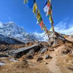
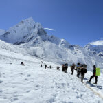
The Kang La Pass is the defining physical challenge and the most spectacular moment of the entire trek. The climb begins before dawn from Nar Village, ascending through rocky moraine, steep scree, and boulder fields before topping out at 5,320 meters where prayer flags mark the crossing point. The panorama from the pass is genuinely extraordinary: Annapurna II, Gangapurna, Tilicho Peak, Chulu East, Pisang Peak, and the broader Damodar Himal range spread across the horizon. Below to the south, the Annapurna Circuit valley stretches toward Manang. The descent to Ngawal on the other side drops roughly 1,660 meters and requires careful footing on steep, loose terrain — demanding, but completely non-technical.
Landscape Diversity
Few treks in Nepal pack this much visual contrast into a single route. The lower sections of the valley from Koto to Meta travel through deep river gorges with raging glacial streams, hanging pine forests, and dramatic cliff faces. Above Meta, the landscape transitions sharply — trees thin out, the valley widens, and the terrain takes on the dry, colorful rock formations and open skies of the trans-Himalayan plateau. By the time you reach Phu, you’re walking through a landscape that looks more like Ladakh or Tibet than anything in the lower Himalayan foothills.
Wildlife and Flora
The Nar Phu Valley falls within the Annapurna Conservation Area and provides critical high-altitude habitat for blue sheep (bharal), Himalayan tahr, marmots, and rarely, but genuinely — snow leopards. The valley is considered one of Nepal’s better zones for snow leopard presence, though sightings require both patience and a degree of fortune. At lower elevations, rhododendron, pine, and oak forest frame the trail in spring and autumn color.
Mountain Views
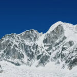
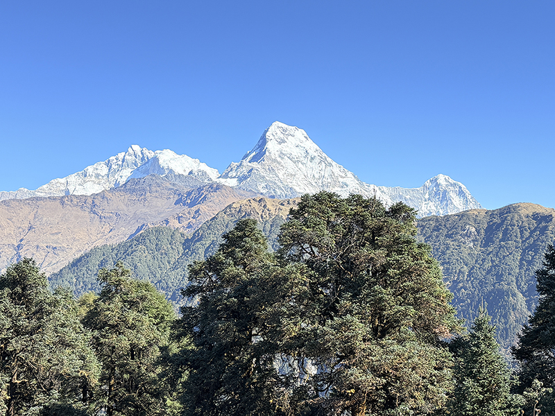
Throughout the trek, the mountain panorama is constant and close. Manaslu (8,163 meters) is visible from the early sections of the route. As you gain altitude, Himlung Himal (7,126 meters), Kang Guru (6,981 meters), Annapurna II (7,937 meters), and the surrounding peaks of the Damodar Himal fill the skyline. The sunrise view from Nar Village across the Himalayan range is one of those moments that trekkers describe as the single image they carry home from Nepal.
Trek Route and Itinerary Overview
The most common version of the Nar Phu Valley Trek runs 12 to 14 days including travel from Kathmandu. Here’s how a well-structured itinerary looks:
Day 1 — Kathmandu to Besisahar (Drive)
The journey begins with a road trip west from Kathmandu along the Prithivi Highway to Besisahar in Lamjung district roughly 6 hours by private vehicle or bus. Besisahar is the administrative headquarters of Lamjung and the traditional starting point for the Annapurna Circuit.
Day 2 — Besisahar to Koto (Drive + Trek)
From Besisahar, a 4×4 jeep covers the rough road north along the Marsyangdi River, through villages like Bhulbhule, Jagat, Dharapani, and Chyamche, reaching Koto at approximately 2,600 meters. The drive passes the famous Bung waterfall at Chyamche and several dramatic gorge sections. At Koto, the trail to Nar Phu branches off the Annapurna Circuit and enters a checkpoint where restricted area permits are checked. Overnight in Koto.
Day 3 — Koto to Meta (Trek, 6-7 hours)
The trail climbs steeply out of Koto into the Nar Phu gorge, following the Phu Khola river through increasingly dramatic terrain. The landscape transitions quickly — within a few hours you’re beyond any significant human settlement, walking through narrow gorge corridors with towering walls on both sides. Meta (3,560 meters) is a small, sparse settlement used primarily as a waypoint for trekkers.
Day 4 — Meta to Kyang (Trek, 5-6 hours)
The trail continues north, gaining altitude steadily. Kyang (3,870 meters) is another small checkpoint stop, set in increasingly dry and open terrain. Mountain views begin to open up significantly from here.
Day 5 — Kyang to Phu Village (Trek, 5-6 hours)
The approach to Phu is one of the most visually striking days of the trek. The valley opens wide as you near the village, and Himlung Himal dominates the skyline to the north. Arriving in Phu (4,080 meters) feels like stepping into a different era — the stone architecture, monastery bells, and near-complete silence are immediately disorienting in the best possible way.
Day 6 — Acclimatization Day in Phu
A rest and acclimatization day in Phu is essential before pushing higher. Most trekkers use this day to hike to the Tashi Lhakhang Gompa, a historic monastery above the village, or to explore the Himlung Base Camp trail for partial views of the peak. This day also provides the best opportunity to interact with Phu’s residents, visit the village monastery during prayer times, and understand the rhythm of life at this altitude.
Day 7 — Phu to Nar Village (Trek, 6-7 hours)
The trail from Phu to Nar climbs over high grazing plateaus and descends into the Nar Valley. This crossing passes through some of the most remote terrain on the entire route — high-altitude meadows, mani stone walls, ancient trade path markers, and views across to the Tibetan plateau that remind you just how close to the border you are. Nar (4,183 meters) is perched on its ridge above the valley, larger and slightly more developed than Phu.
Day 8 — Rest and Exploration Day in Nar
Another critical acclimatization stop before the Kang La Pass crossing. Nar’s monastery is worth extended time, and the ridgeline above the village offers excellent views north toward Tibet and south toward the Annapurna massif. This day builds the physical and mental preparation needed for the following morning’s pass crossing.
Day 9 — Nar to Ngawal via Kang La Pass (Trek, 8-9 hours)
The biggest day of the trek. The climb from Nar to the Kang La Pass (5,320 meters) begins before first light, ascending over rocky ridges and moraine for 4 to 5 hours before reaching the pass. From the top, the full Annapurna panorama unfolds. The descent to Ngawal (3,660 meters) is steep and requires careful footwork but leads back to the Annapurna Circuit trail and the comfort of a more established village.
Day 10 — Ngawal to Besisahar (Drive)
From Ngawal or nearby Humde — which has a small airstrip — a shared jeep ride covers the Annapurna Circuit road south to Besisahar, approximately 6 hours and 98 kilometers.
Day 11 — Besisahar to Kathmandu (Drive)
Return journey to Kathmandu by private vehicle or bus, completing the full circuit.
Required Permits
The Nar Phu Valley is a designated restricted area, and entry requires three separate permits — all of which must be arranged through a registered Nepali trekking agency before the trek begins:
Restricted Area Permit (RAP)
This is the primary permit controlling access to the Nar Phu Valley. The cost varies by season: approximately USD 100 per person per week during peak season (September to November), and USD 75 per person per week during off-peak months (December to August), with an additional USD 15 or USD 10 per day for any days beyond the first week, respectively. This permit can only be obtained through a registered trekking agency — it cannot be purchased individually at any permit office.
Annapurna Conservation Area Permit (ACAP)
Since the Nar Phu trail falls within the Annapurna Conservation Area, this permit is also mandatory. The cost is approximately NPR 3,000 (around USD 23-25) per person and can be obtained through the Nepal Tourism Board offices in Kathmandu or Pokhara, or through your agency.
TIMS Card (Trekkers’ Information Management System)
Required for all trekkers in Nepal. This is a basic registration document obtained through registered agencies or TAAN/NTB offices.
An important practical note: the government of Nepal requires a minimum of two trekkers to obtain the Nar Phu restricted area permit. Solo trekkers who want to do this route independently must pay for two permits — sometimes referred to informally as a “ghost permit.” In all cases, a licensed guide is legally required. Trekking this route without a guide is not permitted under any circumstances.
Trek Difficulty
The Nar Phu Valley Trek is rated moderate to challenging. It doesn’t require technical mountaineering skills or roped climbing, but it does demand solid physical fitness, previous trekking experience at altitude, and a realistic respect for what high-altitude remote terrain involves.
The key difficulty factors are: sustained trekking days of 6 to 9 hours over several consecutive days, significant altitude gain culminating at the Kang La Pass (5,320 meters), remote trail conditions where rescue access is limited and evacuation is slow, and basic teahouse facilities that don’t have the range or comfort of more established routes.
The Kang La Pass crossing specifically requires good cardiovascular endurance. The climb gains roughly 1,200 meters of elevation from Nar Village in a single push, much of it over rocky moraine and scree above 4,500 meters where the air is noticeably thin. Trekkers who have completed routes like the Everest Base Camp trek or the Annapurna Circuit will be well-prepared. First-time trekkers in Nepal will find this route a significant step up, though it’s achievable with thorough preparation and a good guide.
Altitude sickness is a genuine risk anywhere above 3,000 meters. The acclimatization days built into the itinerary at Phu and Nar are not optional — they’re the mechanism that makes the Kang La Pass crossing safe. Trekkers should carry diamox as a precautionary measure and ensure their guide carries a pulse oximeter.
Best Time to Trek Nar Phu Valley
Spring — March to May
Spring is one of the two prime trekking windows. The rhododendron forests below Meta bloom through March and April, trail conditions are stable, skies are generally clear, and temperatures at altitude are cold but manageable. The high passes are accessible from late March onward, though early season attempts on Kang La should factor in possible residual snow from winter.
Autumn — September to November
Autumn is the peak trekking season in Nepal, and for good reason. After the monsoon clears in late September, the air is crystal sharp, visibility extends for hundreds of kilometers, and the mountain views from both the valley and the Kang La Pass are at their absolute best. October is widely considered the single best month for the Nar Phu trek — stable weather, clear skies, and comfortable daytime temperatures on the trail.
Winter — December to February
Winter trekking in Nar Phu is possible but demanding. The Kang La Pass will be heavily snow-covered and potentially dangerous, temperatures at Nar and Phu drop well below -15°C at night, and the trail from Koto to Meta can be icy and hazardous. The permit cost drops in winter, and the solitude is absolute, but this window is recommended only for experienced cold-weather trekkers.
Monsoon — June to August
The monsoon season brings heavy rainfall to the lower sections of the trail, with landslide risk on the gorge sections between Koto and Meta. Interestingly, the upper valley around Phu and Nar — sitting in the Himalayan rain shadow — receives significantly less precipitation than lower elevations, making parts of the route more manageable in monsoon than expected. However, the river crossings become more hazardous, trail conditions deteriorate, and most trekkers avoid this window.
What to Pack
For a trek that crosses a 5,320-meter pass and spends multiple nights above 4,000 meters, gear preparation matters. The essentials:
Clothing: Thermal base layers (top and bottom), mid-layer fleece or down jacket, waterproof and windproof outer shell, insulated down jacket for camp and pass, trekking trousers, warm hat, sun hat, balaclava, liner gloves, insulated waterproof gloves, wool or synthetic socks (multiple pairs).
Footwear: Sturdy, well broken-in waterproof trekking boots with ankle support. Gaiters are useful for the Kang La Pass crossing when snow is present.
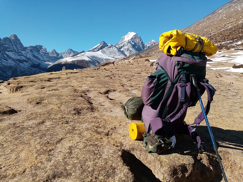
Gear: 50-65 litre trekking backpack, sleeping bag rated to at least -10°C (teahouse blankets at this altitude are often inadequate), trekking poles (essential for the Kang La descent), headlamp with spare batteries, sun protection (sunglasses, SPF 50 sunscreen, lip balm), water purification tablets or a UV pen, blister kit and first aid basics, personal medications including diamox.
Documents: All three permits, passport, travel insurance documents. Ensure your insurance explicitly covers high-altitude trekking above 5,000 meters and helicopter evacuation — this is non-negotiable for any trek at this elevation in a restricted area.
Accommodation and Food
The Nar Phu Valley is a teahouse trek, though the standard of facilities here is more basic than what trekkers find on the Everest or Annapurna main routes. Teahouses in Meta, Kyang, Phu, and Nar offer simple rooms — typically wooden beds with thin mattresses and shared bathrooms — and a menu built around Nepali staples: dal bhat, noodles, fried rice, soup, eggs, and bread. Some teahouses offer apple-based snacks and local butter tea, both of which become surprisingly welcome at altitude.
Hot showers exist at some stops and carry a small surcharge. Charging phones and other devices is available for a fee at most teahouses. WiFi is nominally available at some locations but unreliable — plan for effectively no internet access once you’re past Koto. An NTC or Ncell SIM card purchased in Kathmandu will give you limited but useful signal in some sections of the valley.
The homestay option in Phu — staying in a local family’s home rather than a teahouse — is available and represents a genuinely different experience. Meals are simpler, the living conditions are more basic, but the cultural immersion is on another level entirely. This is worth considering if experiencing local life is a primary goal of your trek.
Combining Nar Phu with Other Routes
The Nar Phu Valley Trek connects naturally with several other routes, making it ideal for trekkers who want to maximize their time in Nepal:
Nar Phu + Annapurna Circuit: The most popular extension. After crossing Kang La to Ngawal, continue on the standard Annapurna Circuit through Manang, over Thorong La Pass (5,416 meters), and down to Muktinath. This adds 6 to 8 days and creates one of the most complete Himalayan trekking experiences available anywhere in Nepal.
Nar Phu + Tilicho Lake: From Manang after the Kang La crossing, a side trip to Tilicho Lake (4,919 meters) — one of the world’s highest lakes — adds 2 to 3 days and is one of the most visually stunning detours in the Annapurna region.
Nar Phu + Himlung Base Camp: An extension from the Phu acclimatization day, the trail toward Himlung Base Camp offers close-up views of Himlung Himal and surrounding glaciers. This is a half-day to full-day addition that doesn’t require extra permits.
Why Nar Phu Valley Stands Apart
The Annapurna region receives over 100,000 trekkers per year. The Nar Phu Valley, sharing the same geographic area, receives a small fraction of that number. The permit system, the minimum group requirement, the guide requirement, and the general absence of marketing infrastructure around this route have combined to keep it genuinely quiet. On most days of the trek beyond Koto, you will encounter very few other trekking groups. In the villages themselves, interactions with locals happen on terms set by the community rather than by the tourism industry.
The culture in Nar and Phu is Tibetan Buddhist in character, but it exists in a form that mass tourism hasn’t smoothed or simplified. Monastery visits here are not organized for tourist convenience — they happen when they happen, on schedules set by monks and festivals, not by trekking itineraries. The people of these villages are warm and curious, but they’re not performing hospitality for visitors. They’re living their lives, and you’re passing through.
That distinction is what makes the Nar Phu Valley different from almost everything else available in Nepal’s trekking landscape right now. The Himalayas here are the same mountains. The altitude is the same challenge. But the experience of moving through a landscape that hasn’t been shaped by decades of trekking infrastructure — where the trail is quiet, the culture is intact, and the feeling of remoteness is real rather than constructed — is something that fewer and fewer places in the Himalayan world can still genuinely offer.
Practical Information at a Glance
Trek Duration: 10 to 14 days (from Kathmandu and back)
Maximum Altitude: Kang La Pass — 5,320 meters (17,454 feet)
Difficulty Level: Moderate to Challenging
Best Seasons: Spring (March–May) and Autumn (September–November)
Starting Point: Koto (2,600 meters), accessed from Besisahar
Permits Required: Restricted Area Permit (RAP), ACAP, TIMS
RAP Cost: USD 100/week (peak season), USD 75/week (off-peak)
Minimum Group Size: 2 trekkers (guide is legally mandatory)
Accommodation: Teahouses and limited homestay options
Approximate Total Cost: USD 900 to USD 3,000 per person depending on group size, itinerary length, and service level
Guide and Porter Rates: Approximately USD 35/day for a licensed guide, USD 25/day for a porter
Book Your Nar Phu Valley Trek with Getaway Nepal Adventure
The Nar Phu Valley Trek requires permit coordination, licensed guides with specific regional experience, and a level of logistical preparation that goes beyond what most standard trekking routes demand. Getting this right — the permits timed correctly, the acclimatization properly scheduled, the guide genuinely familiar with the valley and the Kang La Pass — makes the difference between a trek that delivers what the route promises and one that encounters avoidable problems in genuinely remote terrain.
Getaway Nepal Adventure is a Kathmandu-based, fully registered trekking operator with NTB, TAAN, and Nepal Mountaineering Association credentials, and direct experience operating in Nepal’s restricted trekking zones including the Nar Phu Valley. The team handles all permit applications, guide assignment, route planning, and full logistics from Kathmandu to Kathmandu — so the only thing you need to focus on is showing up fit and ready to walk. If you’re planning a Nar Phu Valley Trek and want it done right, reach out to Getaway Nepal Adventure to start building your itinerary.
Recent Posts