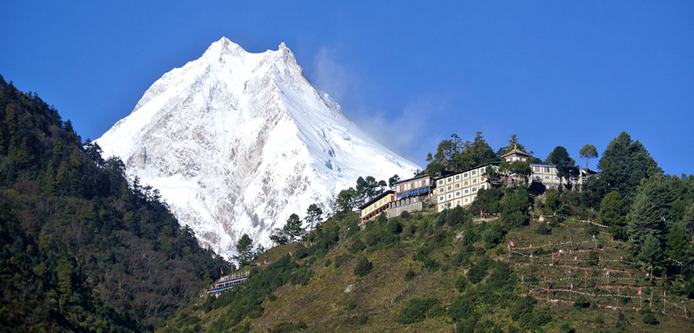
Manaslu Circuit Trekking
Trek at a Glance
- Location: Manaslu Conservation Area, Gorkha District, west-central Nepal
- Distance: approximately 170 to 177 km depending on itinerary
- Duration: 13 to 18 days (Kathmandu to Kathmandu)
- Highest Point: Larkya La Pass — 5,106 to 5,167 meters (sources vary slightly)
- Difficulty: Moderate to Challenging
- Trekking Style: Teahouse — no camping required on the standard circuit
- Best Season: Spring (March to May) and Autumn (September to November)
- Permits Required: Manaslu Restricted Area Permit (RAP), Manaslu Conservation Area Permit (MCAP), Annapurna Conservation Area Permit (ACAP)
- Guide Requirement: Mandatory by Nepali law — solo trekking is prohibited
- Minimum Group Size: Two trekkers
- Trailhead: Machha Khola (accessible by road from Kathmandu)
- Trek Ends: Dharapani — connects to the Annapurna Circuit and onward to Besisahar
Introduction: The Trek Nepal’s Most Experienced Trekkers Keep Coming Back To
There is a paradox at the heart of the Manaslu Circuit Trek. It is one of Nepal’s finest trekking routes — in many experienced opinions, the finest — and yet it remains far less crowded than its neighbours. The Annapurna Circuit and Everest Base Camp draw hundreds of thousands of trekkers each year. The Manaslu Circuit, separated from the Annapurna region by a single ridge and accessible from the same highway, sees a tiny fraction of that traffic.
The reason is restriction. The Manaslu region is a designated restricted trekking area, requiring special government permits and a mandatory licensed guide. This regulatory layer keeps visitor numbers low, and low visitor numbers preserve exactly the qualities that make the trek so compelling: traditional Tibetan-influenced villages that have not been reshaped by mass tourism, trails that feel genuinely wild rather than manicured, teahouses where the hosts are curious about you rather than exhausted by the relentless flow, and mountain views — particularly of Mount Manaslu itself, the eighth highest mountain on earth at 8,163 meters — that you share with remarkably few people.
The circuit follows an ancient salt trading route along the Budhi Gandaki River, climbing from subtropical river valleys through dense bamboo and rhododendron forests, through deep Himalayan gorges, past sacred Buddhist monasteries and Mani stone walls, into the high-altitude Tibetan landscape around Sama Gaon and Samdo, and over the dramatic Larkya La Pass before descending into the Annapurna region at Dharapani. It is a route that compresses an extraordinary range of terrain, culture, and altitude into two weeks of some of the most varied and rewarding walking available anywhere on earth.
This guide covers everything: the route and itinerary day by day, the permits and regulations, the difficulty and what to expect physically, the best seasons, the teahouse accommodation reality, what the trek costs, how to prepare, and how to experience the Manaslu Circuit as it deserves to be experienced — with the knowledge, preparation, and respect it requires.
What Makes the Manaslu Circuit Trek Special?
Plenty of Nepal’s trekking routes are spectacular. The Manaslu Circuit is something more specific than spectacular — it is authentic in a way that the most famous routes can no longer fully claim to be. The distinction matters, and it is worth understanding why.
The restricted area status that limits visitor numbers also limits the commercial pressures that have transformed parts of the Everest and Annapurna regions over the past two decades. In the Manaslu circuit’s high valleys, villages like Sama Gaon and Samdo still function primarily as communities — places where the Nubri and Tibetan-origin peoples live their lives around yak herding, barley farming, and Buddhist religious practice — rather than as service infrastructure for trekking tourism. Trekkers pass through these communities as guests, not as a primary industry to be catered to. The difference in how this feels on the ground is profound.
The cultural density of the route is extraordinary. From the lower Gurung and Magar villages of the Budhi Gandaki gorge, through the transition zones where Nepali Hindu culture blends with Tibetan Buddhist tradition, to the high valleys where the language, architecture, and spiritual life are unmistakably Tibetan — the Manaslu Circuit is an anthropological journey as much as a physical one. The ancient monasteries of Lho, the Ribung Gompa and Pungyen Gompa near Sama Gaon, the prayer wheel corridors and Mani walls that line the trail for kilometres in the upper valleys, the chortens at every ridge and pass — these are not decorative heritage features. They are a living culture.
Mount Manaslu itself shapes the entire experience of the upper circuit in a way that is qualitatively different from how Everest relates to the EBC route. On the Manaslu Circuit, the mountain is a constant companion from the moment you enter the high valleys — visible from Namrung, then increasingly dominant from Lho and Shyala, then overwhelming from Sama Gaon where its full south face rises above you at a proximity that feels almost implausible. Standing in Sama Gaon at 3,520 meters with the summit of Manaslu towering more than 4,600 meters directly above you is one of the most extraordinary mountain experiences Nepal offers.
And then there is the Larkya La Pass. At over 5,100 meters, it is one of the highest trekking passes in Nepal, crossed by relatively few people each year compared to the Thorong La on the Annapurna Circuit. The pass crossing — typically starting at 3 or 4am in the darkness, reaching the top as the first light touches the surrounding peaks — produces views that experienced Himalayan trekkers describe as among the best they have ever seen: Himlung Himal, Cheo Himal, Kang Guru, Nemjung, Gyaji Kang, and the Annapurna range spread across the western horizon as you descend toward Bimthang.
The Route: Day by Day Through the Manaslu Circuit
The standard circuit covers approximately 170 kilometres from Machha Khola to Dharapani over thirteen to fifteen days, depending on the itinerary. The following is a practical day-by-day description of the route as it is most commonly trekked, including the key acclimatization days that responsible operators build into their schedules.
Day 1 | Drive: Kathmandu to Machha Khola
Altitude: 930m / 3,051ft | Distance: ~160 km by road | Walking: 7–9 hrs driving
The journey begins with a long road drive from Kathmandu along the Prithvi Highway, following the Trishuli and Marsyangdi Rivers before turning northwest toward Gorkha. The road becomes rougher as it approaches the Budhi Gandaki valley. Machha Khola, a small settlement of Gurung and Ghale communities at the river’s edge, is the current standard trailhead for the circuit, cutting road walking that used to begin the older itinerary from Soti Khola. Overnight in a local teahouse.
Day 2 | Trek: Machha Khola to Jagat
Altitude: 1,340m / 4,396ft | Distance: ~17–22 km | Walking: 7–8 hrs
The first walking day follows the narrow trail along the Budhi Gandaki River, crossing suspension bridges and passing through Gurung villages. Monkeys appear in the forest sections. A natural hot spring at Tatopani offers welcome relief for tired legs — worth a soak if time allows. The trail crosses and re-crosses the river on a series of cantilever and suspension bridges before reaching Jagat, a stone-paved Gurung village where the first permit checkpoint is located. The entry into the Manaslu Conservation Area is marked here.
Day 3 | Trek: Jagat to Deng
Altitude: 1,804m / 5,918ft | Distance: ~18–24 km | Walking: 8 hrs
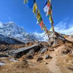
A long day through increasing gorge scenery, passing through the villages of Salleri, Sirdibas, and Phillim — where the trail junction for the Tsum Valley branches right. The Budhi Gandaki narrows dramatically as the walls of the gorge close in on both sides, and the river’s turquoise colour intensifies in the confined canyon. Bamboo and rhododendron forest alternate with rocky riverside sections. Deng is a small Tibetan-origin village with basic teahouse accommodation, surrounded by prayer flags and traditional stone architecture.
Day 4 | Trek: Deng to Namrung
Altitude: 2,630m / 8,628ft | Distance: ~17–20 km | Walking: 7–9 hrs
The trail climbs steadily through forests past the villages of Rana and Bihi Phedi, with white-faced langur monkeys frequently visible in the canopy. The route passes through Ghap and several landslide zones that require careful navigation — your guide’s knowledge of current conditions is particularly valuable on this section. Namrung, perched above the Budhi Gandaki at 2,630 meters, is the best viewpoint for Siring Himal and Ganesh Himal and marks the beginning of the cultural transition into fully Tibetan-influenced territory.
Day 5 | Trek: Namrung to Lho / Shyala
Altitude: 3,180–3,575m | Distance: ~10–13 km | Walking: 5–7 hrs
A shorter day but a dramatic one. The trail climbs steeply out of Namrung through barley terraces to Lihi village, renowned for its chortens, and continues past the village of Sho. At Lho, the massive monastery of Ribung Gompa deserves a visit — an afternoon exploration gives real insight into Tibetan Buddhist monastic life in this remote community. From Lho and the nearby village of Shyala, Mount Manaslu appears for the first time in its full vertical scale: the snow-covered face rising above the valley in a way that almost defies scale perception. Himal Chuli and Ngadi Chuli complete a panorama of extraordinary power.
Day 6 | Trek: Shyala to Sama Gaon (Samagaun)
Altitude: 3,520m / 11,549ft | Distance: ~7–9 km | Walking: 3–4 hrs
A deliberately short day to allow the body to respond to increasing altitude. The trail crosses easy terrain through pine and rhododendron, with Manaslu growing in the view with every kilometre. Sama Gaon, the largest village in the upper Manaslu valley and the main settlement of the Nubri people, sits in a broad valley beneath the mountain. A large active gompa, health post, helipad, and Wi-Fi connectivity (limited but available) make this the main hub of the upper circuit. Pungyen Gompa, a sacred monastery across the valley, is worth the afternoon hike for anyone with energy to spare.
Day 7 | Acclimatisation: Sama Gaon — hike to Manaslu Base Camp or Birendra Tal
Altitude: up to 4,400m / 14,435ft | Distance: ~11 km round trip | Walking: 5–7 hrs hiking
The acclimatisation day at Sama Gaon is non-negotiable. The standard protocol — climb high, sleep low — has trekkers hiking north toward Manaslu Base Camp past the sacred Birendra Tal lake, reaching approximately 4,400 meters before returning to sleep at Sama Gaon. The base camp approach reveals the full scale of Manaslu’s south face glacier system, with the icefall visible at close range. Alternatively, the hike to Pungyen Gompa to the east provides a less strenuous acclimatisation option with excellent mountain views. Overnight again in Sama Gaon.
Day 8 | Trek: Sama Gaon to Samdo
Altitude: 3,865m / 12,680ft | Distance: ~5–8 km | Walking: 3 hrs
A short day by design, allowing continued acclimatisation as altitude increases. The trail leaves the treeline behind entirely, climbing through open yak pastures with long Mani walls lining the path. Samdo, the last village before the high pass, sits just four kilometres from the Tibetan border — on clear days, the Tibetan plateau is visible across the high ridgeline. The village has a small Tibetan refugee community whose presence adds another layer of cultural context to the already rich upper circuit. Yak herds graze the surrounding high pasture.
Day 9 | Acclimatisation: Samdo — hike toward Tibet border
Altitude: up to 5,000m / 16,404ft | Distance: ~12 km round trip | Walking: 6–8 hrs hiking
The second acclimatisation day pushes trekkers to nearly 5,000 meters on a day hike toward the Tibetan border ridge, providing crucial altitude adaptation before the Larkya La crossing. The high ridge offers remarkable views south over the Samdo Glacier and, in season, sightings of blue sheep, pikas, and Himalayan marmots are common. Looking north, the Tibetan plateau stretches beyond the ridge in a vast, barren panorama. Yak caravans occasionally cross the border passes here. Return to Samdo for the night.
Day 10 | Trek: Samdo to Dharmasala (Larkya Phedi)
Altitude: 4,460m / 14,632ft | Distance: ~6 km | Walking: 3 hrs
A short transfer day to position for the Larkya La crossing. Dharmasala — meaning ‘place of rest’ — is a small high-altitude settlement consisting of a few basic teahouses that exist primarily to shelter Larkya La trekkers before the pass crossing. The accommodation is simple and cold, the altitude makes everything harder, and the early-morning departure the following day makes an early night essential. Spend the afternoon resting, eating well, and preparing physically and mentally for the most demanding day of the circuit.
Day 11 | LARKYA LA PASS — Trek: Dharmasala to Bimthang
Altitude: Pass: 5,106–5,167m; Bimthang: 3,590m / 11,778ft | Distance: ~15–18 km | Walking: 9–10 hrs
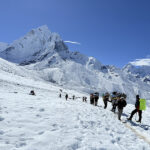
The Larkya La crossing is the summit of the Manaslu Circuit in every sense. Departure at 3 or 4am in darkness, headlamps illuminating the snow and rock above as the trail climbs through glacial moraine and then across the final steep snow slope to the pass. The summit itself is marked by prayer flags and stone cairns, and the panorama from the top — Himlung Himal, Cheo Himal, Kang Guru, Nemjung, Gyaji Kang, and the Annapurna range rising ahead — is one of the finest high-altitude views in Nepal. The descent to Bimthang is long and steep, crossing glacial terrain that requires care, particularly in icy conditions where micro-crampons are advisable. Bimthang, a lush valley with a dramatic backdrop of Manaslu’s west face, feels like a different world after the barren high-altitude landscape of the days before.
Day 12 | Trek: Bimthang to Dharapani
Altitude: 1,860m / 6,102ft | Distance: ~19–21 km | Walking: 7 hrs
A long descent through rhododendron forests, past the village of Gho, through narrow valleys above the Dudh Khola river. The transition from alpine to subtropical landscape happens visibly as altitude drops — vegetation thickens, temperature rises, and the air feels suddenly dense and rich with oxygen after days in thin mountain air. Dharapani marks the junction with the Annapurna Circuit trail and the effective end of the Manaslu restricted area. Accommodation standards jump noticeably here, as Dharapani is an established Annapurna Circuit stop with better-developed facilities.
Day 13 | Drive: Dharapani / Besisahar to Kathmandu
Altitude: Kathmandu: 1,400m | Distance: ~170–200 km by road | Walking: 5–7 hrs driving
A jeep or bus from Dharapani or Besisahar (depending on road conditions) returns trekkers to Kathmandu along the Marsyangdi and Trishuli river valleys. The drive provides a final view of the Annapurna range before the lowlands close in. Most trekkers arrive in Kathmandu by mid-afternoon — enough time for a hot shower, a proper meal, and the particular exhausted satisfaction of having completed one of Nepal’s great circuits.
Note: A 14-day or 15-day itinerary adds an additional acclimatisation or rest day at Sama Gaon or Namrung, and is strongly recommended for trekkers who have not previously trekked above 4,000 meters. The extra days significantly reduce AMS risk at Larkya La and improve the overall quality of the experience.
Manaslu Circuit vs Annapurna Circuit: An Honest Comparison
The Manaslu Circuit and the Annapurna Circuit share a border, connect at Dharapani, and are both considered among Nepal’s finest multi-week trekking routes. They are also genuinely different experiences, and the differences matter for choosing the right trek for your interests, expectations, and trekking style.
The Annapurna Circuit is longer, more developed, and more varied in terms of infrastructure. It has the iconic Thorong La Pass at 5,416 meters — higher than Larkya La — and passes through the rain-shadow region of Mustang with its extraordinary barren landscape and ancient cave dwellings. The trails are well-maintained, teahouse options at every stage are plentiful and often excellent, and the route is understood and signposted with the confidence of four decades of commercial trekking development. The cost of this development is crowd density, particularly in peak season when the trail between Manang and the Thorong La becomes genuinely congested.
The Manaslu Circuit is shorter, more remote, and culturally more intact. The trails feel wilder — more natural, less worn, less managed — and the villages have not been reshaped by the volume of trekking tourism that the Annapurna Circuit carries. The permit restriction keeps numbers low enough that you can walk for hours without seeing another group, sit in a teahouse without competing for space, and have genuine conversations with local people who are curious about you rather than habituated to your presence. The teahouse facilities are simpler above Namrung, and the trail at its highest sections is more demanding and less forgiving of poor weather.
The honest verdict: if you want cultural authenticity, solitude, and a wilder mountain experience, the Manaslu Circuit is the better choice. If you want more varied infrastructure, a higher pass, and the Mustang landscape, the Annapurna Circuit has its own compelling case. Many experienced Nepal trekkers do both over successive visits and regard them as complementary rather than competing experiences.
How Difficult Is the Manaslu Circuit Trek?
The Manaslu Circuit is rated moderate to challenging, and both parts of that description matter. It is not a technical trek — there is no rope work, glacier travel in the mountaineering sense, or technical climbing required. But it is a genuinely demanding physical undertaking that should be approached with honest preparation rather than the assumption that determination alone will carry you through.
The daily walking demands are real. Most days involve six to eight hours of walking, with some days — particularly the approach to Namrung and the Larkya La crossing itself, which can run nine to ten hours — exceeding that significantly. The terrain includes stone staircases, river crossings on suspension bridges, rocky ridgeline traverses, and the final glacial moraine approach to Larkya La. Cumulative fatigue over thirteen to fifteen consecutive days is a factor that many trekkers underestimate, particularly those whose training has been primarily short single-day hikes.
The altitude is the primary challenge. Larkya La at over 5,100 meters is serious altitude for most bodies, and the days leading up to it — spent at 3,500 to 4,500 meters in the upper circuit villages — require the body to adapt to conditions that no amount of sea-level fitness fully simulates. The acclimatisation days at Sama Gaon and Samdo are not optional padding in the itinerary; they are the physiological mechanism by which the body adjusts to altitude. Operators who skip or shorten these days to save time are creating unnecessary risk for their clients.
The remoteness adds a dimension of seriousness that more accessible treks lack. Above Sama Gaon, the nearest road and the nearest hospital are days away. Emergency evacuation by helicopter is possible — and a requirement of responsible travel insurance — but weather conditions can ground helicopters for extended periods. This is not a reason to avoid the trek; it is a reason to prepare properly, to take altitude symptoms seriously from their first appearance, and to trust an experienced guide’s judgment over personal ambition.
The benchmark for readiness: if you can walk six to seven hours carrying a daypack on consecutive days, have completed at least one multi-day trek previously (ideally with some altitude above 3,000 meters), and have put in three to four months of consistent cardiovascular and leg strength training before departure, the Manaslu Circuit is achievable. The physical preparation is what allows you to be mentally present for the experience rather than simply surviving it.
Permits: What You Need and What It Costs
The Manaslu Circuit requires three separate permits, all of which must be arranged through a registered trekking operator. Independent permit acquisition is not possible for the Restricted Area Permit, which is the primary permit required for entry into the Manaslu region. This requirement effectively mandates booking through an operator, which is not a commercial inconvenience but a conservation mechanism — the permit system limits access, manages visitor numbers, and funds the conservation of an ecologically and culturally sensitive region.
Manaslu Restricted Area Permit (RAP)
The RAP is the core permit for trekking in the Manaslu restricted zone and is issued by the Government of Nepal’s Department of Immigration. The cost varies by season: during the peak autumn trekking period (September to November), the permit costs USD 100 per person for the first seven days and USD 15 for each additional day. During all other months (December through August, which includes spring trekking season), the cost is USD 75 for the first seven days and USD 10 for each additional day. A standard thirteen to fifteen-day itinerary spending approximately ten days in the restricted area will cost between USD 145 and USD 190 per person in permit fees for the RAP alone, depending on season and exact days.
Manaslu Conservation Area Permit (MCAP)
The MCAP is required for entry into the Manaslu Conservation Area and funds the conservation management of the region’s ecological systems. The cost is approximately NPR 3,000 per person (roughly USD 22 to 25 at current exchange rates). This permit can be obtained in Kathmandu through your trekking operator.
Annapurna Conservation Area Permit (ACAP)
Because the Manaslu Circuit exits into the Annapurna region at Dharapani, an ACAP is required for the final section of the trek. The cost is also approximately NPR 3,000 per person (roughly USD 22 to 25). Some itineraries that exit the circuit before entering Annapurna jurisdiction may not require this permit, but the standard circuit does.
Total permit costs for a standard autumn circuit run between USD 160 and USD 240 per person. All permits are arranged by your operator and require passport photographs and copies of your travel documents. Carry originals of all permits throughout the trek, as multiple permit checkpoints exist along the route where documentation is verified.
Cost: What Does the Manaslu Circuit Trek Actually Cost?
The total cost of the Manaslu Circuit Trek depends significantly on how you organise it — the choice between a budget local operator, a quality mid-range operator, or a premium international agency produces very different price points, as does your approach to accommodation, meals, and tipping practices on the trail.
As a general baseline for 2025 and 2026, a fully organised thirteen to fifteen-day Manaslu Circuit Trek from Kathmandu with a reputable local operator — including permits, licensed guide, porter service, teahouse accommodation in twin-sharing rooms, three meals per day, and road transport to and from the trailhead — ranges from approximately USD 900 to USD 1,500 per person. Premium packages with private rooms, upgraded accommodation where available, and additional services run higher. International operators layering their fees on top of local ground costs can push total prices to USD 2,000 to USD 3,000 or more per person.
Beyond the package price, budget for trail extras. Teahouse Wi-Fi costs USD 3 to 5 per session at lower elevations. Device charging costs USD 2 to 4 per session. Hot showers where available run USD 3 to 5. Bottled water becomes increasingly expensive at altitude — using your own filter bottle eliminates this cost and reduces plastic waste. A reasonable budget for trail incidentals is USD 20 to 30 per day above and beyond what a package covers.
Tipping is standard practice and genuinely important. Guides and porters on Nepal’s restricted area treks work extremely hard in challenging conditions and depend on tips as a meaningful portion of their income. A reasonable tip for a guide over a thirteen-day trek is USD 100 to 200 per trekker; for a porter, USD 50 to 100 per trekker. These amounts should be discussed with your operator and budgeted before departure.
Best Time to Trek the Manaslu Circuit
Autumn: September to November
The prime season and the most popular window for the Manaslu Circuit. Post-monsoon skies offer exceptional clarity, mountain views are at their best, and trail conditions are stable and dry. October is considered the peak of the peak — the skies are clearest, the temperature at altitude is cold but manageable (ranging from comfortable at midday in lower villages to well below freezing at night above 4,000 meters), and the full power of the surrounding peaks is on display. The trade-off is that autumn also brings the highest permit costs and the most competition for teahouse beds, particularly at Sama Gaon and Samdo. Booking accommodation in advance through your operator is essential in October.
Spring: March to May
The second and equally valid prime season. Spring brings the extraordinary rhododendron bloom to the lower and middle sections of the circuit, with the forests between Deng and Namrung transformed by the red and white flowering that defines Nepal’s spring Himalayan landscape. Mountain views are generally good, weather is typically stable, and trail conditions are safer than winter. The permit costs are lower than autumn (USD 75 for the first seven days of RAP versus USD 100). Crowds are lower than peak autumn, and the daytime temperatures at altitude are slightly warmer. Late April brings increasing pre-monsoon cloud build-up that can reduce afternoon mountain visibility, so the window of March through mid-April generally offers the best combination of conditions.
Winter: December to February
Winter trekking on the Manaslu Circuit is possible but seriously demanding and should only be considered by experienced high-altitude trekkers with appropriate cold weather gear. The Larkya La Pass is typically heavily snow-covered from December through February, and conditions on the pass can range from difficult to impossible depending on recent snowfall. Many teahouses above Sama Gaon close in deep winter. Those that remain open offer limited menus and services. Temperatures at altitude regularly drop below minus twenty degrees Celsius overnight. For those with the experience, gear, and flexibility to wait out bad conditions, winter Manaslu offers absolute solitude and, on clear days, mountain views of extraordinary clarity and crispness.
Monsoon: June to August
The monsoon season is not recommended for the Manaslu Circuit on the standard route. Heavy rainfall increases landslide risk substantially, particularly in the lower gorge sections of the Budhi Gandaki where the trail crosses many unstable steep slopes. Leeches are a persistent presence on the lower trail in monsoon conditions. Mountain views are largely obscured by cloud. However, the Manaslu region does not have a classic rain-shadow zone like Upper Mustang, so monsoon trekking here lacks the weather protection that makes monsoon viable in that area.
Accommodation and Food on the Manaslu Circuit
The teahouse network on the Manaslu Circuit is genuinely functional but honestly simpler than what the Everest and Annapurna regions offer. This is part of the authentic character of the trek — the teahouses feel like what they are: locally owned guesthouses run by mountain families who have adapted their homes to accommodate the small but steady flow of trekkers through their villages — but it requires realistic expectations rather than disappointment.
In the lower villages from Machha Khola to Namrung, teahouses offer reasonable twin-sharing rooms, basic shared bathrooms, hot showers (charged separately), electricity for device charging (also charged), and reasonable menu variety. As altitude increases above Lho and Sama Gaon, the facilities simplify. Rooms become colder and more basic, menu options narrow, hot water becomes less reliable or unavailable, and the physical infrastructure reflects the difficulty of supplying anything to communities this remote and this high.
Dharmasala — the final overnight before Larkya La — is the most basic accommodation on the circuit. The guesthouses there exist specifically to shelter Larkya La trekkers for a single night, and comfort is not a realistic expectation. What matters is warmth, a bed, and a meal before the 3am start. Experienced operators advise trekkers to lower expectations for this specific night and focus on rest rather than comfort.
Dal bhat remains the best meal choice throughout the circuit. It is fresh, locally appropriate, nutritionally suited to the demands of multi-day high-altitude trekking, and typically refillable at no extra cost — an important consideration when caloric demands are high and appetite at altitude can be unpredictable. The Tibetan-origin villages of the upper circuit also offer tsampa porridge, yak butter tea, and Tibetan bread as culturally specific options that are worth trying for their authenticity as much as their nutritional value.
The Larkya La Pass: The Heart of the Circuit
The Larkya La Pass deserves its own section because it is genuinely the defining experience of the Manaslu Circuit and the moment that every trekker on the route is building toward from the first day. Everything that precedes it — the acclimatisation days, the altitude management, the early nights, the careful pacing — exists in service of getting trekkers to the top of this pass in good health and getting them safely down the other side.
The pass sits at between 5,106 and 5,167 meters depending on the measurement source — effectively around 5,160 meters for practical purposes. The approach from Dharmasala begins in darkness, typically at 3 to 4am, for the simple reason that the pass is safest in the morning hours before the wind picks up. By mid-morning, even in good weather, the Larkya La is typically exposed to strong, cold wind that makes extended time at the top uncomfortable and cold management difficult.
The climb from Dharmasala to the pass takes three to four hours at altitude pace. The trail crosses glacial moraine and then ascends a steep snow slope to the ridge. The final approach is where accumulated fatigue and altitude combine most severely — this is where trekkers who have not acclimatised properly feel the effects most acutely, and where the value of those rest days at Sama Gaon and Samdo is felt most directly.
At the pass, the view that opens to the west is what experienced trekkers describe in language that sounds like hyperbole until you stand there yourself. A vast glacial cirque reveals itself — Himlung Himal, Cheo Himal, Kang Guru, Nemjung, and Gyaji Kang arranged in a natural amphitheatre that spills glaciers into the valley below, with Annapurna II rising on the far horizon. The view back east toward Manaslu, with the mountain’s full profile visible from this elevation, completes a panorama that justifies every hard day of the approach.
The descent to Bimthang is steep and long, crossing terrain that can be icy and demanding on tired legs and knees. Micro-crampons or crampons are advisable in most conditions on the upper descent. Trekking poles are essential. The emphasis after the summit is on safe, controlled descent rather than speed — this is where many of the pass crossing’s injuries occur, as the combination of relief at having summited and exhaustion from the long day can reduce the careful attention that steep icy terrain requires.
Culture and Communities Along the Route
The cultural experience of the Manaslu Circuit is inseparable from the physical journey, and engaging with it seriously makes the trek a fundamentally richer experience than treating it as a mountain walk with villages in the background.
The lower circuit from Machha Khola to Jagat passes through communities of Gurung and Magar origin — ethnic groups whose traditions, language, and social structures reflect Nepal’s mid-mountain cultural belt. The women’s dress, the style of the houses, the agricultural practices of terraced millet and maize farming, and the village social organisation all belong to this cultural tradition. Moving north from Jagat, the trail passes through a transition zone where these cultural markers gradually shift toward Tibetan Buddhist influence as the altitude and proximity to the Tibetan border increases.
By Namrung and Lho, the architecture has transitioned to the flat-roofed stone houses of the Tibetan tradition. Prayer wheels line the trails. Mani stones — flat stones carved with Buddhist mantras, most commonly ‘Om Mani Padme Hum’ — are stacked in long walls beside the path, and the etiquette requires passing to their left (walking clockwise around them) in accordance with Buddhist tradition. Monasteries appear at increasing frequency, active religious centres rather than heritage sites, with monks in residence and regular liturgical schedules.
Sama Gaon is the cultural heart of the upper circuit. The Nubri people, a Tibetan-origin community whose ancestors settled this valley centuries ago along the ancient Tibet-Nepal trading routes, have maintained a way of life here that is remarkably intact. The community’s social organisation, religious practice, language, and agricultural traditions all continue within a framework that trekking tourism has not significantly disrupted — partly because the restricted access limits the disruption, and partly because the Nubri community has historically been selective and self-protective about outside influence.
Engaging respectfully with these communities — asking permission before photographing people, learning a few words of Nepali or Tibetan greeting, showing genuine interest in what your guide explains about local practice rather than treating cultural encounters as spectacle — transforms the experience in ways that no amount of landscape appreciation can replicate. The quality of cultural engagement on the Manaslu Circuit is, in many ways, its most enduring legacy for trekkers who approach it with genuine openness.
Wildlife and Natural Environment
The Manaslu Conservation Area covers an area of approximately 1,663 square kilometres and protects one of the most ecologically diverse regions in Nepal. The altitudinal range — from subtropical river valleys at around 800 meters to permanent snowfields above 7,000 meters — produces a corresponding range of ecological zones, each with distinct plant communities and wildlife.
The lower circuit below Namrung passes through subtropical and temperate forest zones dominated by oak, alder, maple, and pine, with dense bamboo in the gorge sections. Rhododendron forests at middle elevations — particularly spectacular in spring bloom — give way to birch and juniper at higher altitudes. Above the treeline, alpine meadows and high-altitude scrub transition to glacial terrain and permanent ice.
Wildlife sightings on the Manaslu Circuit are genuinely common compared to more trafficked routes. Langur monkeys and red-faced macaques are frequently observed in the forest sections of the lower circuit. Himalayan Tahr — a large wild goat with dramatic curved horns — grazes the alpine meadows above 3,500 meters and is visible from many trail sections in the upper circuit. Blue sheep (bharal) are particularly abundant near Samdo and on the acclimatisation hikes toward the Tibet border. Himalayan marmots emerge from their burrows on sunny days in the high pastures. Snow leopard, though present in the conservation area, is rarely seen by trekkers — but the possibility adds an electric quality to scanning the high ridgelines.
The birdlife is exceptional. The Manaslu Conservation Area hosts over 33 species of mammals and over 110 species of birds, including the Himalayan monal (Nepal’s national bird), the blood pheasant, various vulture species, and at higher elevations the lammergeier (bearded vulture) with its distinctive wingspan of nearly three meters.
Altitude Safety: Managing the Circuit’s Primary Risk
The Manaslu Circuit’s altitude profile — starting below 1,000 meters and reaching over 5,100 meters at Larkya La — spans a range that requires systematic altitude management. Unlike some shorter treks where altitude is an inconvenience, on the Manaslu Circuit it is the primary safety consideration and demands respect from every trekker regardless of fitness level or previous experience.
Acute Mountain Sickness can begin to present at altitudes above 2,500 meters, though it most commonly becomes a significant issue above 3,500 meters. The initial symptoms — persistent headache that does not respond well to paracetamol, nausea, unusual fatigue, loss of appetite, and poor sleep — are the body’s signal that ascent has been faster than its adaptation capacity. The correct response at this stage is to remain at the same altitude until symptoms fully resolve before ascending further.
The Manaslu Circuit’s two mandatory acclimatisation days — at Sama Gaon around 3,520 meters and at Samdo around 3,865 meters — are spaced to allow gradual adaptation to the altitudes required before the Larkya La crossing. These days are not optional for most trekkers, and operators who compress itineraries to reduce cost or duration by eliminating these days are creating serious altitude risk for their clients. If you feel symptoms at any stage of the circuit, communicate immediately with your guide — they are trained to assess altitude symptoms and make the descent call when necessary.
The absolute rules of altitude management apply here without exception: if symptoms are worsening rather than improving after rest at the same altitude, descend immediately. Helicopter evacuation from the Manaslu region is possible and expensive — travel insurance covering high-altitude evacuation and medical treatment is non-negotiable. Ensure your policy specifically covers trekking above 5,000 meters and helicopter rescue, as standard travel insurance typically does not.
Packing for the Manaslu Circuit
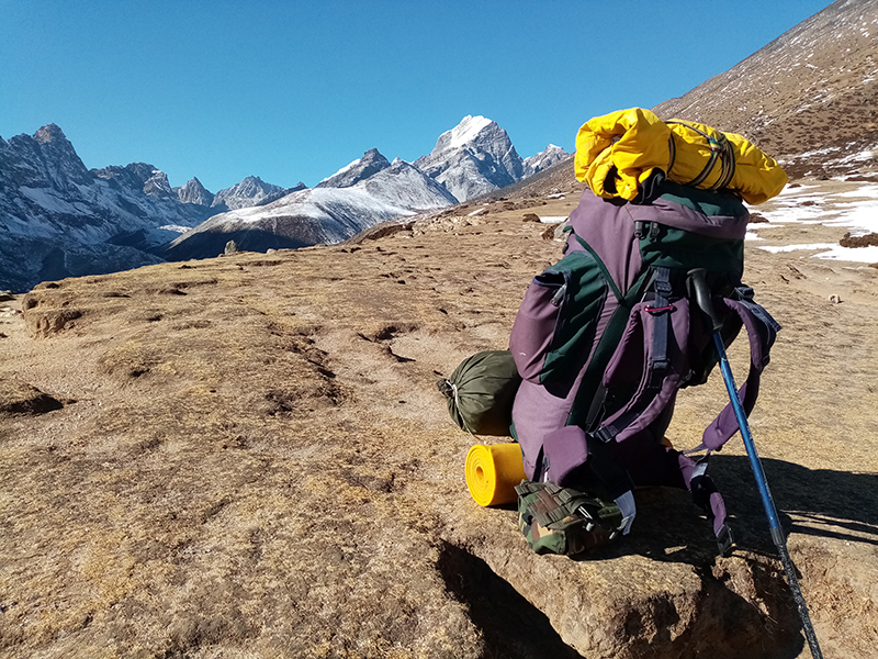
The Manaslu Circuit’s environmental range — from subtropical heat at the trailhead to the intense cold of the Larkya La at over 5,100 meters — requires a packing strategy built around versatile layering rather than volume. Every kilogram in your pack is a kilogram that affects your performance over thirteen to fifteen consecutive days. Pack light, but pack correctly.
Essential Clothing
- Moisture-wicking base layer — merino wool preferred for multi-day odour management
- Insulating mid-layer — down jacket or synthetic insulated jacket for upper circuit evenings and Larkya La crossing
- Waterproof outer shell — Gore-Tex or equivalent for rain and wind
- Thermal long underwear for nights above 3,500 meters
- Warm hat covering ears, and gloves — essential above 4,000 meters in any season
- Neck gaiter or balaclava for Larkya La crossing
- Trekking trousers — synthetic or wool, not cotton
- Lightweight layers for warm lower circuit days — removable as altitude increases
Footwear and Support
- Waterproof, ankle-supporting trekking boots — broken in over a minimum of 50+ kilometres before departure
- Micro-crampons or crampons for the Larkya La crossing — mandatory in most conditions, especially the descent
- Trekking poles — non-negotiable on this route, particularly for descent management
- Gaiters for snow and wet trail conditions in upper circuit
Essential Gear
- Sleeping bag rated to at least minus 15 degrees Celsius — the upper circuit nights are cold
- Headlamp with fresh batteries — essential for the 3am Larkya La departure
- Power bank with full capacity — charging opportunities become sporadic above Namrung
- Water purification — filter bottle or tablets; stream water is available but must be treated
- Sun protection — high-SPF sunscreen, UV-protective sunglasses, sun hat; UV intensity at altitude is severe
- First aid kit including blister supplies, paracetamol, rehydration sachets, and any prescription medications
- Travel insurance documentation confirming high-altitude trekking and helicopter evacuation coverage
- All permit documents and passport copies in a waterproof bag
- Cash in Nepali rupees — sufficient for the full circuit duration, as ATMs are not available on the trail
Extending the Circuit: Tsum Valley and Beyond
The Tsum Valley, accessible from the trail junction near Deng on day three of the standard circuit, is one of Nepal’s most remarkable restricted area trekking destinations and a natural extension of the Manaslu Circuit for trekkers with additional time and a deep interest in Tibetan Buddhist culture.
The Tsum people — the indigenous Tsumba community of this side valley — have maintained a cultural and religious tradition of extraordinary purity and depth, shaped by centuries of relative isolation in a valley that was effectively a hidden corner of the Himalayan world until it was opened to limited trekking in 2008. Sacred Buddhist sites including the Mu Gompa, the Rachen Monastery, and the Milarepa cave — Pigeon Cave, known locally as Piren Phu — make the Tsum Valley a pilgrimage route as well as a trekking destination.
Adding the Tsum Valley to the standard Manaslu Circuit extends the trip to approximately eighteen to twenty-two days and requires additional permits (a separate Tsum Valley Restricted Area Permit). The combined Manaslu Circuit and Tsum Valley trek is considered by many experienced Nepal trekkers to be one of the finest extended Himalayan journeys available anywhere — a route that combines the physical achievement of the Larkya La crossing with the cultural depth of one of the most intact Tibetan Buddhist communities outside Tibet.
Trek the Manaslu Circuit with Getaway Nepal Adventure
Getaway Nepal Adventure is a Kathmandu-based trekking operator with specific expertise in the Manaslu region and its restricted area permit logistics. Our guides on the Manaslu Circuit are experienced professionals who know this route across seasons, understand the altitude profile and how to manage it responsibly, and bring the cultural knowledge and local connections that transform a challenging high-altitude trek into a genuinely transformative experience.
We operate the Manaslu Circuit with proper acclimatisation schedules built into every itinerary — not compressed to reduce cost, but designed to give every trekker the best possible chance of completing the circuit safely and in good health. We work with the local teahouse operators, guides, and porter communities whose livelihoods depend on responsible trekking tourism in this region, and we operate according to ethical employment and sustainability standards that reflect our commitment to the communities we work within.
What We Offer
- Standard 13-day Manaslu Circuit Trek with all permits, licensed guide, and teahouse accommodation
- Extended 15-day itinerary with additional acclimatisation days — recommended for first-time high-altitude trekkers
- Combined Manaslu Circuit and Tsum Valley Trek — 18 to 22 days for the complete experience
- Private programs for individuals and small groups with customised pace and services
- Group programs for universities, academic institutions, and corporate teams
- Full permit logistics — RAP, MCAP, ACAP, and any additional restricted area permits handled completely
- Porter services with fair wages, proper equipment, and ethical employment standards
- Pre-trek orientation covering route, altitude management, gear, cultural protocols, and safety systems
- 24/7 on-ground support throughout your program
The Manaslu Circuit is waiting. It is one of the last great Himalayan treks that still feels genuinely wild.
Recent Posts